GARDEN WILDLIFE SIGHTINGS
A -
F,
G - L,
M - S,
T -
Z
OUT AND ABOUT WILDLIFE SIGHTINGS
A - F,
G - L,
M - S,
T - Z
RECOMMENDED SEASONAL WALKING
THE
DARTMOOR WALK 1999
the exmoor walk
2002 -
NEW
THE DARTMOOR
WALK 2004
THE DARTMOOR
WALK 2005
A WALK ALONG THE KINGSTON
SEYMOUR COAST
A WALK ALONG THE
CONGRESBURY YEO
RECOMMENDED SEASONAL WALKING
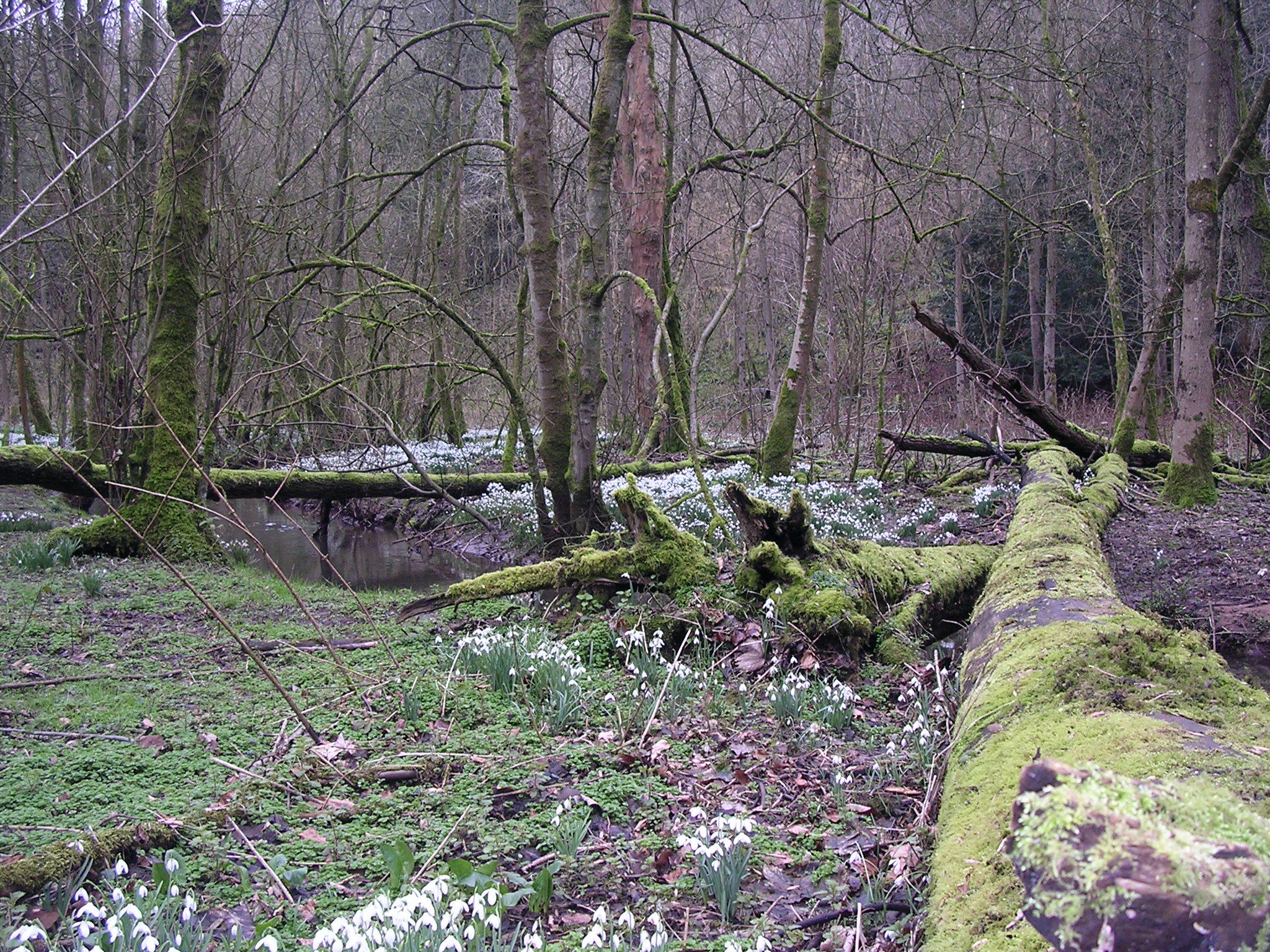
January - February
The
time of year for Snowdrops and having walked the Snowdrop walk at
Cromhall and Tortworth Lake for several years it can be thoroughly
recommended. Walk instructions and details can be found by following
this link
CROMHALL SNOWDROP WALK.
Back To Menu
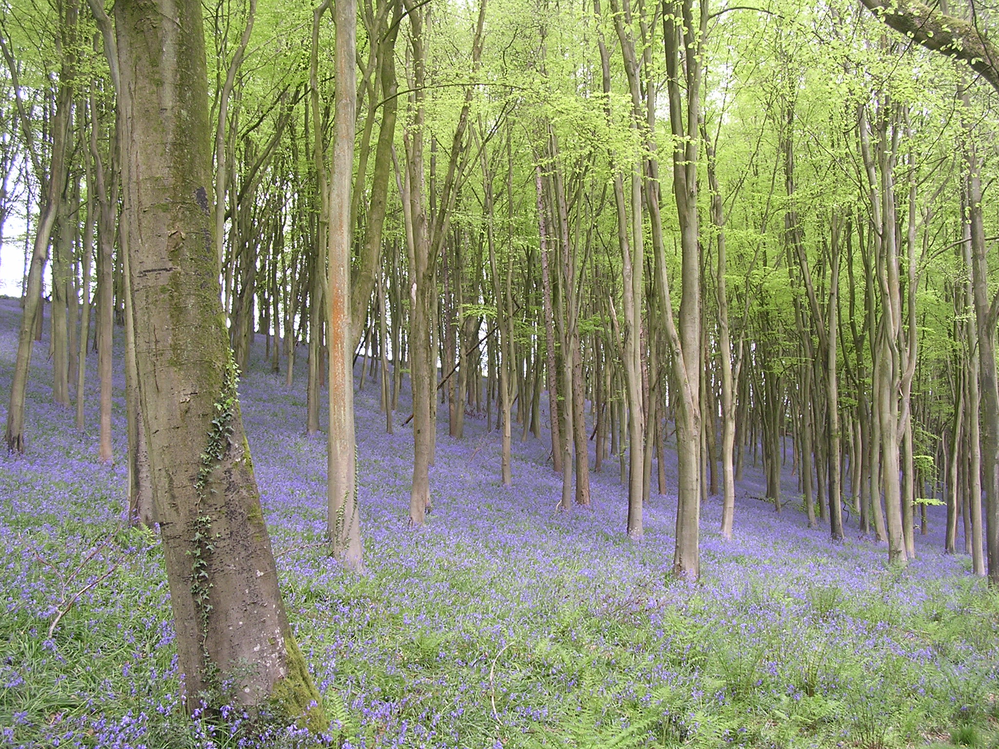
APRIL
spring is in the air and in
my experience there is no better place to enjoy the Bluebells than at
Prior's Wood, Portbury, North Somerset. Walk instructions and details
can be found by following this link
PRIORS WOOD
BLUEBELL WALK
Back To Menu
MAY
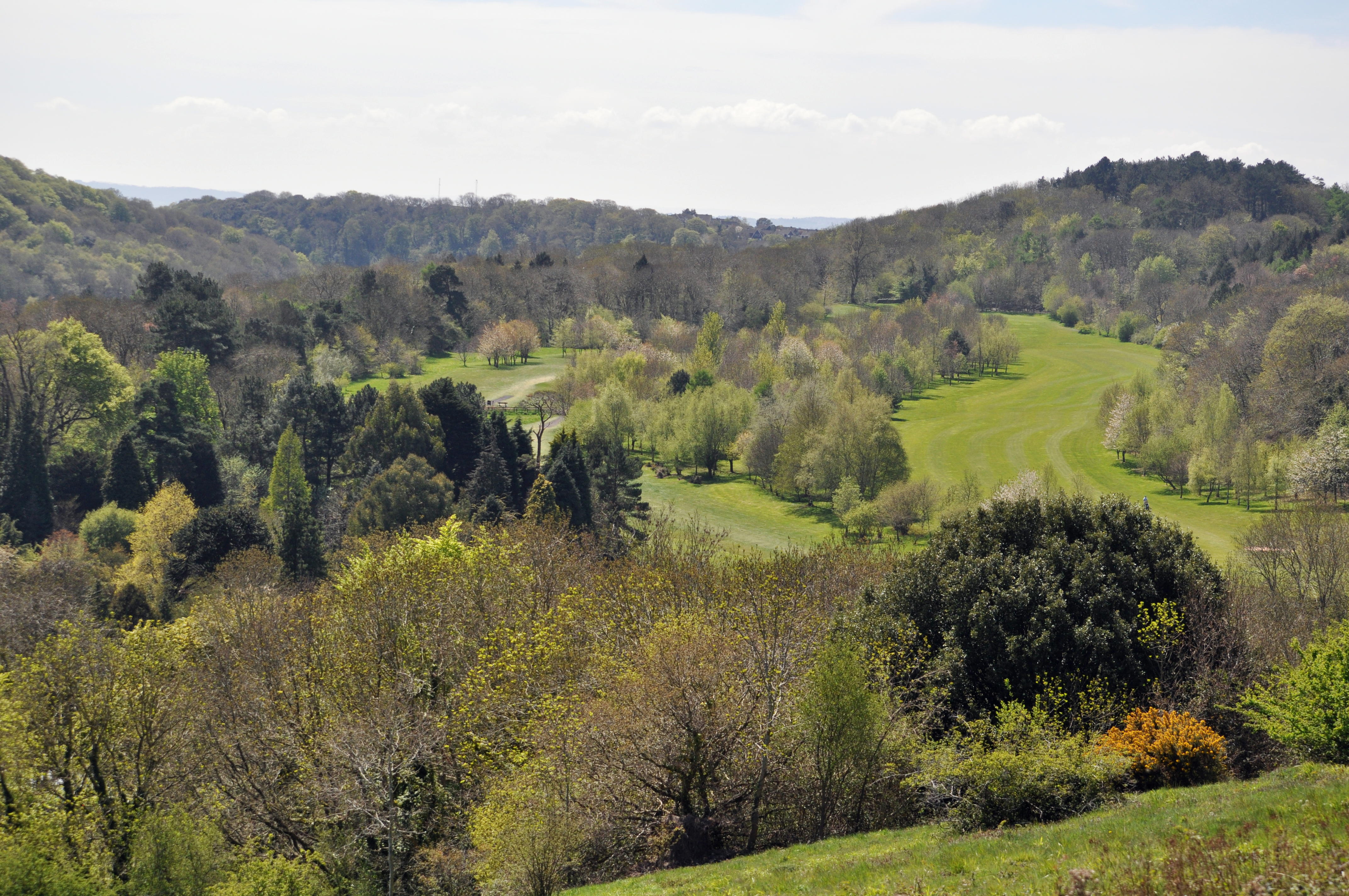
LADYE BAY TO WALTON COMMON, NORTH SOMERSET.
START AT THE CAR PARK IN BAY ROAD,
CLEVEDON, north SOMERSET.
OS MAP 154 BRISTOL WEST AND PORTISHEAD,
CONGRESBURY AND CHEW MAGNA ST 409726.
A
UNDULATING CIRCULAR WALK OF 6km which can be wet and muddy,
SOME MODERATE CLIMBS ESPECIALLY ON THE
COMMON .
WALK 200M DOWN BAY ROAD TO REACH STEPS
ON YOUR LEFT LEADING DOWN TO A FOOTPATH. TAKE THE STEPS TO THE FOOTPATH AND TURN
IMMEDIATELY RIGHT ONTO THE FOOTPATH. DO NOT TAKE THE STEPS AHEAD WHICH LEAD DOWN
TO THE PEBBLE BEACH AT LAYDE BAY UNLESS YOU FANCY A PADDLE (WHEN THE TIDES IN).
FOLLOW THE FOOTPATH (INITIALLY UPHILL)
THROUGH TREES AND ALONG THE COAST FOR 600M BEFORE EXITING THE TREES AND
GOOD VIEWS ACROSS AND UP AND DOWN THE MOUTH OF THE SEVERN UNFOLD.
CONTINUE ENJOYING THE VIEWS FOR ANOTHER
1400M BEFORE TURNING RIGHT OVER A WOODEN STYLE INTO A FIELD. HEAD UPHILL
FOR 300M TO A STYLE AND WOODEN GATE WHICH LEADS ONTO A STONY LANE.
TAKE THIS LANE TO ITS JUNCTION WITH A METALLED ROAD.
CAREFULLY FOLLOW THE ROAD DOWNHILL (NO PAVEMENT) FOR
350M PAST THE GOLF COURSE ON YOUR RIGHT TO A SIGNPOSTED FOOTPATH ON YOUR LEFT.
CAREFULLY CROSS THE METALLED ROAD AND TAKE THIS
STONY FOOTPATH UPHILL TO A WOODEN KISSING GATE. PASS THROUGH THE GATE AND THERE
IS AN AVON WILDLIFE TRUST INFORMATION BOARD REGARDING WALTON COMMON.
USING THE BOARD YOU CAN CHOSE YOUR ROUTE TO
EXPLORE THE COMMON DEPENDING ON YOUR WALKING ABILITY AS THERE ARE STEEP AND NOT
SO STEEP CLIMBS TO ACCESS THE TOP OF THE COMMON .
WHICHEVER ROUTE YOU CHOOSE RETRACE YOUR STEPS USING THESE INSTRUCTIONS FOR FOR
THE RETURN WALK. ASSUME YOUR RETURN STARTS FROM THIS INFORMATION BOARD.
Back To Menu
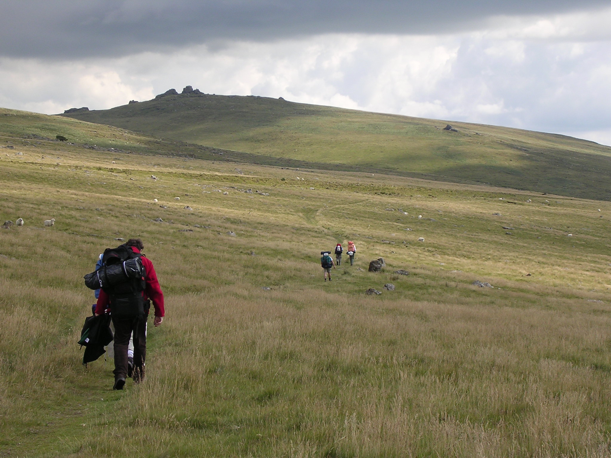
THE DARTMOOR WALK 1999
IVYBRIDGE TO CHAGFORD
HAVING
WATCHED MY 15 YEAR OLD SON TRAIN AND SUCCESSFULLY COMPLETE TWO
TEN TORS
EXPEDITIONS AT BRONZE LEVEL (35 MILES) IT DID NOT SEEM A DIFFICULT
CHALLENGE FOR MYSELF AND FOUR OTHER FRIENDS TO ATTEMPT A SIMILAR WALK. AFTER
SEVERAL TRIALS AND THE BENEFIT OF MY SONS TEN TORS EXPERIENCE WE EVENTUALLY
SETTLED ON THE ROUTE, THE KIT AND THE PROVISIONS REQUIRED. WE WERE
SURPRISED THAT WHEN SHARED BETWEEN US THE KIT AND PROVISIONS AMOUNTED TO
13 KGS PER PERSON.
DAY 1
THE
WALK STARTED AT
IVYBRIDGE IN SUNSHINE AT 16.00HRS ON A FRIDAY. WITH
SOME APPREHENSION WE LEFT THE CARS AND STARTED OUT TO LOCATE
THE TWO MOORS
WAY AND THE BEGINNING OF THE WALK.
HEADING
UP BUTTERDON HILL {364 METRES) AND ON TO UGBOROUGH BEACON {371 METRES)
BEFORE TURNING TOWARDS PILES HILL (387 METRES}
WE PASSED
SPURRELS
CROSS AND JOINED THE TWO MOORS WAY AGAIN WHICH FOLLOWED THE TRACK
OF REDLAKE TRAMWAY AN OLD RAILWAY/TRAMWAY WHICH RAN BETWEEN CANTRELL AND THE OLD
REDLAKE CHINA CLAY WORKS..
OUR
MAP READING AND COMPASS SKILLS WERE TESTED WELL IN THOSE FIRST FEW MILES
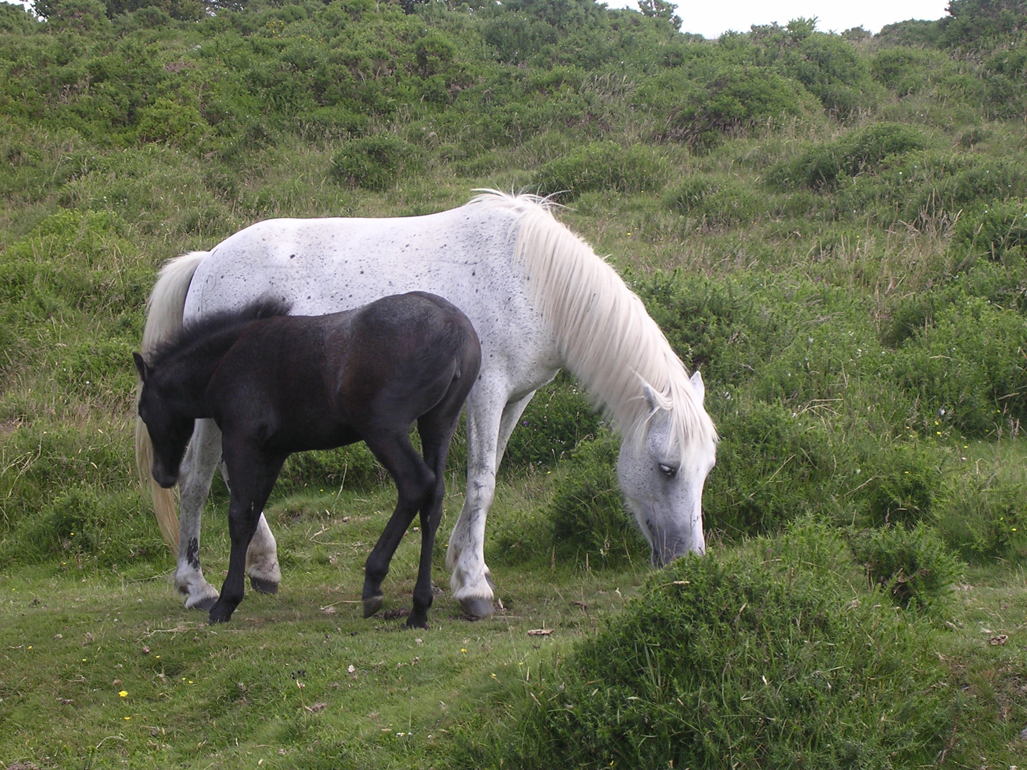
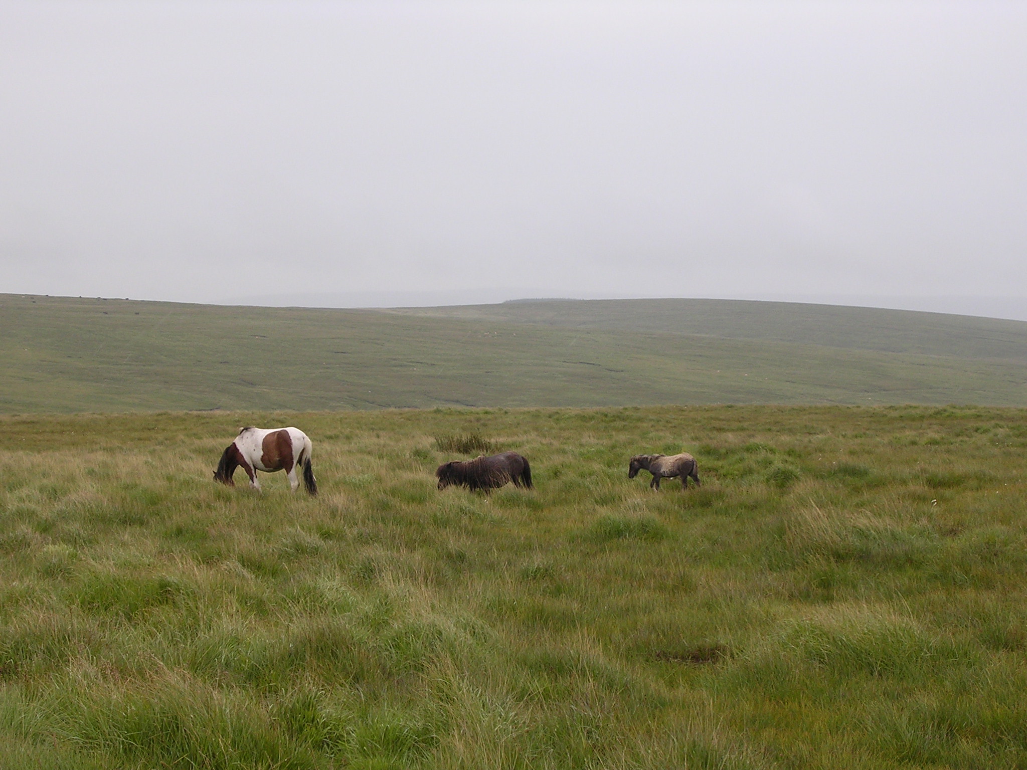
AND WITH ONLY DARTMOOR PONIES FOR COMPANY WE NOW HAD SOME IDEA OF
HOW ISOLATED YOU COULD BE WHEN WALKING ACROSS THE MOOR.
CONTINUING
WITH THE RIVER ERME ON OUR LEFT WE PASSED SHARP TOR AND WITH THREE BARROWS (460
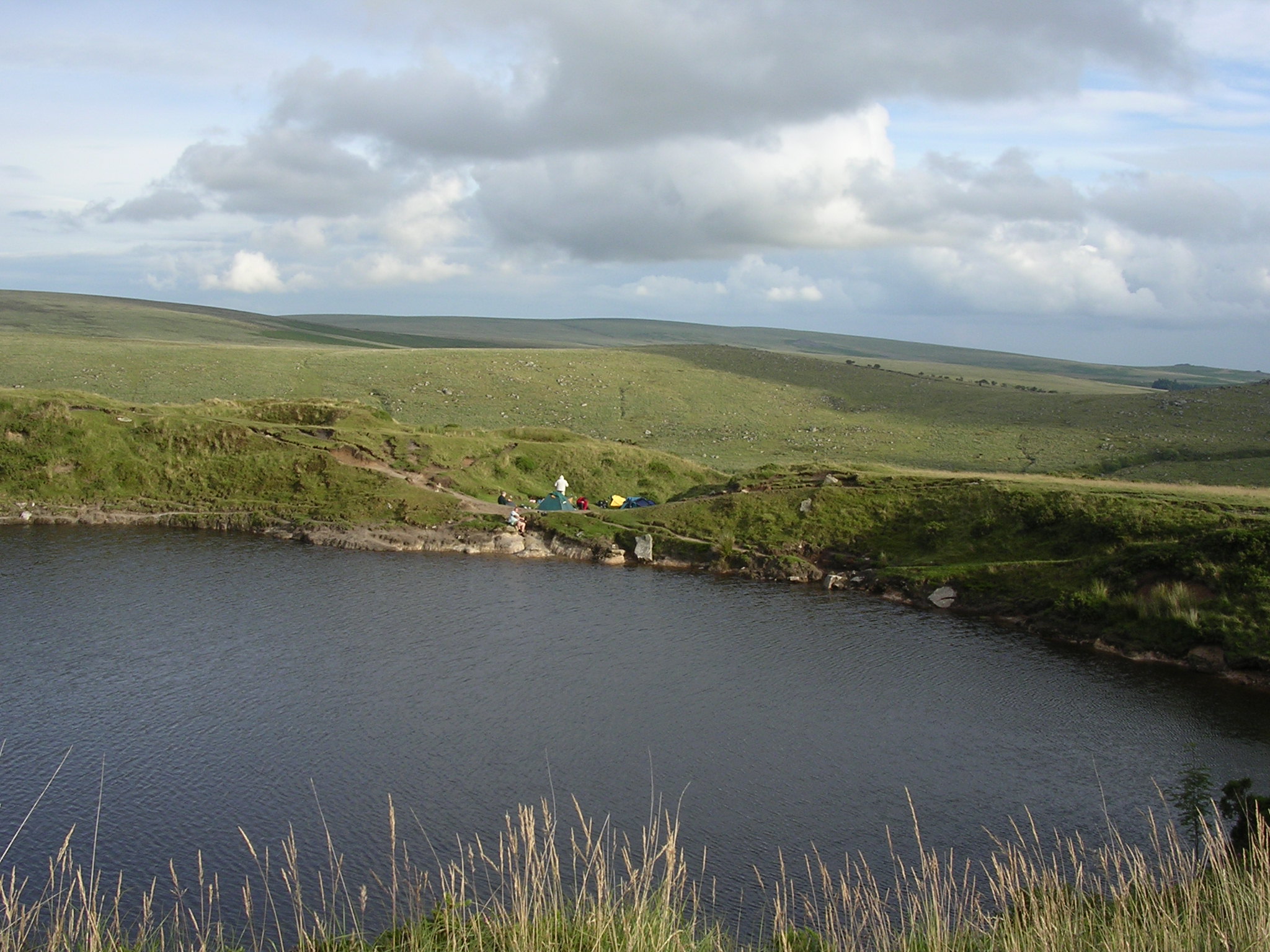
METRES) ON OUR RIGHT WE HEADED TOWARDS OUR PLANNED OVERNIGHT CAMP (410 METRES)
NEAR THE LEFT LAKE TO THE RIGHT OF THE TRACK WHERE
IT BRIDGES THE LAKE OUT FALL.
AT 20.00HRS
WE MADE CAMP AND COOKED OUR EVENING MEAL OF HOT DOGS AND PORK CHOPS FOLLOWED
BY SPOTTED DICK AND CUSTARD AND LIBERAL AMOUNTS OF TEA AND COFFEE.
A SUNNY EVENING WITH A WONDERFUL SUNSET
WAS SPOILT ONLY BY A COLD WIND WHICH
INCREASED DURING THE NIGHT MAKING IT DIFFICULT TO SLEEP AS IT
NOISILY FLAPPED THE FABRIC OF THE TENTS.
DAY 2
WE
WERE WOKEN EARLY AT 03.30 HRS WITH A BRIEF BUT VERY LOUD DAWN CHORUS TO
FIND OUR CAMP SHROUDED IN DENSE MIST. NO WONDER THE BIRDS GAVE UP SINGING
SO SOON.
BY 07.00
HRS WE HAD EATEN OUR BREAKFAST OF PORRIDGE OATS, SAUSAGES AND HOT
BEVERAGES AND BROKEN CAMP.
WITH
VISIBILITY AT 15 METRES WE CONTINUED TO FOLLOWED THE TRACK
TO QUICKBEAM HILL (440 METRES) AND ON TO BROWN HEATH.
HERE
WE TURNED RIGHT OFF THE TRACK AND HEADED DOWN TOWARDS THE RIVER AVON. WE FOUND
OUR COMPASS AND MAP DIFFICULT TO USE IN THE POOR VISIBILITY BUT THANKFULLY
WE HAD A GPS IN OUR KIT WHICH AIDED US IN EVENTUALLY LOCATING THE
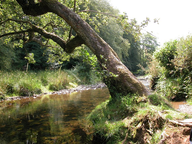
RIVER AND THE CLAPPER BRIDGE. TECHNOLOGY TO THE RESCUE !
HAVING
CROSSED THE RIVER BY THE BRIDGE WE TOOK A BRIEF REST, A SNACK AND
THE OPPORTUNITY OF FILLING OUR WATER BOTTLES (AND MY BOOTS) FROM THE CLEAN
WATERS OF THE FAST FLOWING RIVER. BY NOW
THE SUN WAS BEGINNING TO BREAK THROUGH THE MIST AND HAVING RESTED WE HEADED
TOWARDS THE AVON DAM RESERVOIR BEFORE TURNING UP TOWARDS HICKATON HILL
AT THE HUNTINGDON CROSS.
FROM HICKATON HILL (430 METRES) TO PUPERS HILL (470 METRES) AND ON TO THE SNOWDON
CAIRNS (500 METRES) BEFORE HEADING DOWN TO THE RIVER MARDLE AND A WELL
EARNED BREAK FOR LUNCH. WE RELAXED IN GLORIOUS SUNSHINE AND TREATED OUR
FEET TO A REFRESHING DIP IN THE COLD WATER OF THE RIVER.
AFTER
LUNCH WE CLIMBED UP ONTO HOLNE MOOR (450 METRES) AND HEADED TOWARDS HORNS
CROSS AND ON TO MEET A METALLED ROAD NEAR COMBERSTONE TOR. FROM
HERE WE FOLLOWED THE ROAD TO HEXWORTHY MAKING THE FOREST INN JUST IN TIME
FOR SOME LIQUID REFRESHMENT BEFORE LAST ORDERS.
CONTINUING
ALONG THE ROAD TO HUCCABY WE CROSSED THE WEST DART RIVER TO MEET THE B3357. CLOUDS
WERE GATHERING AND WITH THE SUN DISAPPEARING AND
A MIST FALLING RAPIDLY WE CROSSED THE B3357 AND HEADED UP TO HUCCABY TOR (350
METRES) AND ON TO LAUGHTER TOR (410 METRES).
CONSCIOUS
OF THE PLAN TO REACH CHAGFORD BY MIDDAY TOMORROW AND THE SLIPPAGE OF OUR
SCHEDULE DUE TO THE DENSE MIST EARLIER IN THE DAY WE DECIDED TO COVER AS
MUCH GROUND AS POSSIBLE TODAY IN ORDER TO LEAVE A STROLL FOR SUNDAY MORNING. PUSHING
OURSELVES WE CONTINUED ON TO BELLEVER TOR (440 METRES) AND INTO THE FOREST
MAKING FOR
POSTBRIDGE
AND THE B3212 WHICH WE REACHED AFTER A WELCOME STOP
FOR A BREW AND A SNACK.
HAVING
EXAMINED THE CLAPPER BRIDGE WE HEADED ALONG THE B3212 TOWARDS
BENNETTS
CROSS BEFORE GIVING IN TO OUR TIREDNESS JUST PAST THE
WARREN HOUSE INN.
OUR OVERNIGHT CAMP WAS SET IN A GULLY AT THE FOOT OF HURSTON RIDGE AND BY THE
TIME TENTS WERE PITCHED AND FOOD WAS ON THE GO LIGHT WAS FADING FAST AND HEAVY
DRIZZLE HAD SET IN. HAVING EATEN A HEARTY MEAL OF BEEF STEW AND DUMPLINGS AND
DESPITE BEING IN CLOSE PROXIMITY OF ALCOHOL WE WERE ALL TOO TIRED TO VENTURE
BACK DOWN THE TRACK TO THE PUB SO AN EARLY NIGHT WAS HAD BY ALL.
DAY 3
UP
WITH THE LARK (LITERALLY) AND WITH ONLY SHEEP FOR COMPANY WE POKED ARE
HEADS OUT OF THE TENTS TO FIND A DULL DAMP AND MISERABLE DAWN GREETING
US. THE
FIRST TASK WAS TO DON THE WATERPROOFS MAKE HOT DRINKS AND PREPARE BREAKFAST
OF PORRIDGE OATS, SAUSAGES AND WHATEVER ELSE EDIBLE THAT COULD BE FOUND
IN OUR RUCKSACKS.
BY 07.00HRS
WE HAD BROKEN CAMP AND WERE MAKING TRACKS FOR
BENNETTS
CROSS WHERE WE TURNED
LEFT OFF THE ROAD TO HEAD ACROSS CHAGFORD COMMON TOWARDS METHERALL
AND FERNWORTHY RESERVOIR. ALTHOUGH
THE WAKING WAS EASIER NOW SOME OF THE TEAM WERE BECOMING WEARY AND FEELING
PARTICULARLY IN THE LEGS AND KNEES THE EFFECT OF 2 DAYS HARD WALKING.
THE
SKY WAS NOW BEGINNING TO BRIGHTEN ALONG WITH OUR SPIRITS, ONLY 5
HOURS AND WE WERE TO BE AT OUR RENDEZVOUS WITH THE LADIES IN CHAGFORD.
AT METHERALL
WE FOLLOWED THE METALLED TRACK TOWARDS YARDWORTHY AND JOINED THE TWO MOORS
WAY AGAIN. BY NOW
THE SUN WAS SHINING, WATERPROOFS WERE OFF, THE LANDSCAPE WAS LESS
BLEAK AND MORE POPULATED, PICTURESQUE IN FACT. WHAT A WONDERFUL DAY !
CONTINUING
ALONG THE TWO MOORS WAY WE NEGOTIATED RAISED WOODEN WALKWAYS TO CROSS MARSHES
BEFORE REACHING TEIGNCOMBE WHERE WE JOINED THE ROAD TO CHAGFORD. WE WERE
NOW ON THE HOME RUN FOLLOWING THE ROAD AND THE NORTH TEIGN RIVER PAST HOLYSTREET
MANOR AND INTO
CHAGFORD.
BELIEVE
IT OR NOT WE REACHED CHAGFORD ON TIME AND IN TIME TO SEE THE LADIES ARRIVE
WITH TRANSPORT TO RETURN US TO THE START OF THE WALK AND TO PICK UP THE
CAR FOR THE JOURNEY HOME. PERFECT TIMING !
NOT
THE END HOWEVER , WE STILL HAD TO CELEBRATE OUR ACHIEVEMENT, A STOP IN
THE PUB FOR A DEBRIEF WITH THE LADIES OVER A WELL DESERVED MEAL AND A PINT
OF BEST.
WHAT'S
NEXT CHAPS ???
Back To Menu
THE
EXMOOR WALK 2002
KNOWSTONE TO LYNMOUTH
This walk is dedicated to the
memory of a life long friend, work colleague and walking team member whose life
was prematurely taken from us in 2015.
Wherever you may be wandering may
your bivvy and boots always keep you dry and your 'Wonkey Donkey' cider keep
your whistle wetted.
AFTER COMPLETING
THE TWO MOORS
WAY WALK FROM ITS SOUTHERLY
BEGINNING IN IVYBRIDGE TO CHAGFORD IN 1999 IT SEEMED LOGICAL TO CONSIDER COMPLETING
ITS WALKING TO ITS NORTHERLY END IN LYNMOUTH. OUR TEAM
LEADER BUOYED BY HIS PREVIOUS LEADERSHIP SUCCESS SOON HAD A WALK PLANNED.
STARTING FOR CONVENIENCE IN KNOWSTONE AND ENDING IN LYNMOUTH THE REST OF THE
TEAM WERE EAGER TO FOLLOW HIM ON ANOTHER ADVENTURE. THIS WALK WOULD BE A LITTLE
DIFFERENT IN THAT IT WOULD BE NECESSARY TO PREARRANGE CAMP SITES AS WILD
CAMPING IS NOT PERMITTED IN THE EXMOOR NATIONAL PARK AND THERE WOULD ALSO BE A NEW
AND YOUTHFUL TEAM MEMBER JOINING US. OTHER THAN THIS IT WOULD
BE THE SAME IN THAT THE TEAM WOULD BE CARRYING THE KIT AND THE PROVISIONS REQUIRED
FOR THE JOURNEY.
OS EXPLORER MAP OL9 COVERS MOST OF THE ROUTE.
DAY 1
THE
WALK STARTED NEAR
KNOWSTONE
UNDER OVERCAST SKIES AT 12.00HRS ON A FRIDAY. WITH
CONFIDENCE WE LEFT OUR LADIES AND OUR TRANSPORT IN THE WESTBOUND KNOWSTONE REST
AREA ON THE A361 AND STARTED OUT TO LOCATE
THE TWO MOORS
WAY
AND THE BEGINNING OF THE WALK. OUR FIRST CHALLENGE WAS CROSSING
THE A361 TO SKIRT KNOWSTONE INNER MOOR AND JOIN THE TWO MOORS WAY. WITH
SOME CAUTION WE SUCCEEDED IN CROSSING THE ROAD AND SOON LOCATED THE WAY MARKED
ROUTE.
WE HEADED NORTH ALONG LITTLE USED METALLED ROADS AND AT KNOWSTONE MOOR CROSS WE TURNED RIGHT TOWARDS KNOWSTONE BEFORE TAKING A FOOTPATH
TO OUR RIGHT TO ENTER THE VILLAGE. TURNING RIGHT AT THE END OF THE FOOTPATH WE PASSED THE
THATCHED 13TH CENTURY MASONS ARMS PUBLIC HOUSE. (SHAME IT WAS CLOSED).
AFTER PASSING THE MASONS ARMS WE HEADED EAST BEFORE TURNING
NORTH ACROSS THE CROOKED OAK STREAM AND EVENTUALLY EAST ALONG THE LANE TO OWLABOROUGH. SOON THE METALLED LANE BECAME A GREEN FOOTPATH WHICH
WOULD BE OUR ROUTE
ACROSS OWLABOROUGH MOOR TOWARDS EASTER NEW MOOR.
HEADING NORTH ACROSS OWLABOROUGH MOOR WE REACHED THE
B3227 ROAD WHERE WE CROSSED ONTO EASTER NEW MOOR.
still heading in the same direction AND with A hedgerow ON our right WE REACHED
ANOTHER METALLED ROAD AND CONTINUED NORTH AT
THE 'T' JUNCTION SIGNPOSTED TO YEO MILL.
FOLLOWING THE METALLED ROAD WE CROSSED THE COURSE OF
THE OLD
D&SR TAUNTON TO BARNSTABLE RAILWAY
(WHICH HAD A
HALT AT YEO MILL) AND REACHED THE VILLAGE OF YEO MILL.
CONTINUING ALONG THE ROAD WE CROSSED THE RIVER YEO BEFORE ARRIVING AT A CROSS ROADS WHERE WE TURNED RIGHT TOWARDS DUNSLEY.
HEADING EAST AND AROUND A COUPLE OF VERY SHARP BENDS
THE ROAD CROSSED A STREAM BEFORE STRAIGHTENING. AFTER SOME 300 METRES AND BEFORE THE
ROAD STARTED TO DESCEND WE TOOK AN UPHILL, NARROW AND ROUGH GREEN LANE ON OUR
LEFT WHICH TOOK US TOWARDS WEST ANSTEY.
DESCENDING INTO WEST ANSTEY THE PATH REACHED A
METALLED ROAD WHICH WE FOLLOWED FIRSTLY EAST AND THEN NORTH LOOKING FOR BADLAKE
LANE AND BADLAKE FARM. BADLAKE FARM WAS TO BE THE SITE OF OUR DAY 1 CAMP BUT THE
FARM WAS PROVING DIFFICULT TO LOCATE UNTIL BY
CHANCE ONE MEMBER OF THE TEAM DISCOVERED OVERGROWN SIGNAGE IN THE HEDGEROW AT A
ROAD JUNCTION WHICH DIRECTED US TO THE FARM.
THIS CAMPSITE HAD BEEN PRE-ARRANGED BY THE TEAM LEADER
WITH THE LADY FARM OWNER AS WILD CAMPING IS NOT
PERMITTED ON EXMOOR. THE TEAM WAS VERY CURIOUS AS TO THE SITE OF THE CAMP AND ON
ARRIVAL AT THE FARMHOUSE WERE EAGER TO BE SHOWN TO ITS LOCATION.
HAVING FOUND THE FARM OWNER SHE COURTEOUSLY LEAD US
TO THE SITE AND AFTER NAVIGATING THROUGH SEVERAL BARNS AND UNDER SEVERAL
VERY LOW DOORWAYS WE EVENTUALLY EMERGED AT THE
REAR OF THE FARMHOUSE INTO AN ENCLOSURE PREVIOUSLY USED FOR THE KEEPING OF
CHICKENS.
RELIEVED TO HAVE A PLACE TO SLEEP FOR THE NIGHT THE
TEAM QUICKLY SET ABOUT PITCHING CAMP AMONGST CHICKEN RUNS AND CHICKEN REARING
PARAPHERNALIA. WE SETTLED INTO MAKING PREPARATIONS FOR
DINNER WHILST ONE TEAM MEMBER AMUSED THE REST BY
DONNING A TEA SHIRT EMBLAZONED WITH A FETCHING PRINT OF A NAKED YOUNG LADY.
UNBEKNOWN TO ONE TEAM MEMBER THIS TEA SHIRT SOMEHOW MANAGED TO FIND ITS WAY INTO
THEIR BACKPACK RESULTING IN SOME AWKWARD QUESTIONS FROM HIS LADY WHEN HE
EVENTUALLY EMPTIED HIS BACKPACK ON RETURNING HOME.
DINNER WAS TO CONSIST OF LAMB CHOPS, SAUSAGES,
ONION, MANGE
TOUT AND SAVOURY RICE FOLLOWED BY RICE PUDDING WITH SULTANAS . MUCH TO THE
DELIGHT OF THE TEAM A BOTTLE OF MERLOT WINE WHICH HAD BEEN SECRETLY AND
CAREFULLY CARRIED FROM THE START OF THE WALK BY ONE OF THE TEAM WAS MAJESTICALLY
PRODUCED TO ACCOMPANY THE DINNER.
IT SOON BECAME APPARENT THAT A VITAL ELEMENT OF OUR
PROVISIONS HAD BEEN LEFT AT HOME. TEAM LEADER TO THE RESCUE !!! HE TOOK STOCK OF THE
SITUATION AND QUICKLY MANAGED TO BARGAIN WITH THE FARM LADY AND OBTAIN HER ONLY LOAF OF BREAD WHICH WOULD FORM PART OF OUR BREAKFAST. HE'S A
REAL LADY CHARMER!!!
WHEN IT CAME TO OPENING THE WINE NO CORKSCREW COULD
BE FOUND SO THERE WAS NO ALTERNATIVE BUT TO PUSH THE CORK INTO THE BOTTLE WITH A METAL TENT PEG. IT WORKED A TREAT BUT WITH A LITTLE SPILLAGE, NEVERTHELESS THE WINE WAS
GOOD AND THOROUGHLY
ENJOYED BY ALL.
BY THE TIME DINNER HAD BEEN EATEN AND DIRTY DISHES
WASHED DARKNESS WAS FALLING. AFTER A DEMONSTRATION BY THE NEW TEAM
MEMBER (GADGET MAN) OF THE LIGHT OUTPUT
FROM HIS MAGNIFICENT TORCH WE RETIRED TO OUR TENTS FOR SLEEP.
DAY 2
THE FIRST THING WE BECAME AWARE OF WAS THE CROWING OF
A VERY LOUD COCKEREL AND DAWN BREAKING.
IT WAS 05.00HRS
WITH A GOOD TEAM EFFORT BY 05.45HRS BREAKFAST OF SAUSAGE,
BACON AND EGG, TOAST AND MARMALADE WAS READY.
BY 07.00HRS THE SUN WAS WELL UP, CAMP HAD BEEN
STRUCK, OUR CAMP FEES HAD BEEN PAID AND WE WERE ON THE ROAD WALKING UP BADLAKE
LANE TOWARDS BADLAKE MOOR CROSS AND THE BOUNDARY OF THE EXMOOR NATIONAL PARK.
WE CONTINUED NORTH ACROSS WOODLAND COMMON AND ON REACHING RIDGE ROAD THE TEAM STOPPED AT THE
CONVENIENTLY SITED ROADSIDE SEAT TO REMOVE SOME OF OUR NOW UNNECESSARY CLOTHING.
STILL FOLLOWING THE TWO MOORS WAY WE HEADED ACROSS
ANSTEY MONEY COMMON TOWARDS HAWKRIDGE AND AT THE TOP OF THE RIDGE (350 METRES)
HAWKRIDGE AND THE RIVER BARLE VALLEY CAME INTO VIEW.
THE FOOTPATH THEN DESCENDED THROUGH WOODLAND AND
EVENTUALLY MET A METALLED ROAD WHERE WE TURNED LEFT AND ALONG THE ROAD HEADING
TO THE BRIDGE OVER DANE'S BROOK WHICH MARKS THE BOUNDARY BETWEEN DEVON AND
SOMERSET.
AFTER CROSSING THE BRIDGE THE ROAD CLIMBED
STEEPLY BEFORE REACHING THE FOOTPATH ON OUR RIGHT LEADING TO HAWKRIDGE. HERE THE
TEAM LEADER HOPED TO PURCHASE SOME MORE PROVISIONS FOR THE REMAINDER OF THE WALK.
ENTERING HAWKRIDGE IT WAS DISCOVERED THAT IT HAD A
POST OFFICE BUT UNFORTUNATELY IT WAS NOW CLOSED AND HAD BEEN FOR A LONG
WHILE JUDGING BY THE DUSTY APPEARANCE OF THE HUGE PAIR OF STAG'S ANTLERS
DISPLAYED IN THE WINDOW. CONTINUING WE TURNED LEFT AT THE TELEPHONE BOX AND
RIGHT OVER A STILE AS WE HEADED FOR ROW DOWN WOOD, PARSONAGE FARM AND TARR
STEPS.
WALKING
through SEVERAL Fields WITH THE RIVER BARLE VALLEY ON OUR RIGHT The path RAN
INTO and then along the edge of Great Cleeve Wood. BY NOW THE WEIGHT OF 'GADGET
MANS' EXTENSIVE KIT WAS TAKING ITS TOLL CAUSING PAINFUL BLISTERS ON HIS FEET. SO,
HERE IN OUR EFFORTS TO LIGHTEN HIS LOAD AND EASE HIS PAIN WE briefly STOPPED AND DISTRIBUTED SOME OF HIS KIT AMONGST
the rest of the team.
EVENTUALLY THE PATH reached a moorland road coming from Hawkridge Common ON OUR
left. HERE WE PASSED through A car park and WENT slightly left AND down through
Row Down Wood to cross a stream.
on the far
side of the stream crossing there Was a path junction, HERE WE TOOK the track to
the right towards Parsonage Farm. still HEADING through woodland The track
climbed SHARPLY away from the river TOWARDS Parsonage Farm WHICH WAS almost on THE
hill top.
Passing
Parsonage Farm
WE LEFT THE WOODLAND BEHIND
and followed a series of fieldside paths
along the eastern spur of Parsonage Down. WITH hedgerows ON our right
APPROXIMATELY 700 metres beyond the farm the PATH HEADED out across the middle
of a FIELD and then turned right at the far end BEFORE heading downhill to the
south. At the BOTTOM of the FIELD it entered the wood above the Tarr Steps HOTEL.
SOON THE PATH EXITED THE WOOD INTO A LANE WHERE WE
TURNED LEFT AND AFTER APPROXIMATELY 100 METRES OF DOWNHILL WALKING WE REACHED A DESERTED TARR
STEPS
.
WITH THE PLACE TO OURSELVES (EXCEPT FOR A VERY TAME
CHAFFINCH AND ROBIN) WE TOOK THE OPPORTUNITY TO REMOVE OUR BACK PACKS AND
EXPLORE AND PADDLE IN THE FORD. IT WAS NOW 08.30HRS AND NEARLY 3 HOURS SINCE
BREAKFAST and BY UNANIMOUSLY DECISION THE TEAM VOTED TO PUT THE
KETTLE ON AND PARTAKE OF REFRESHMENTS.
AFTER A SHORT REST WE WERE ON THE MOVE AGAIN WALKING
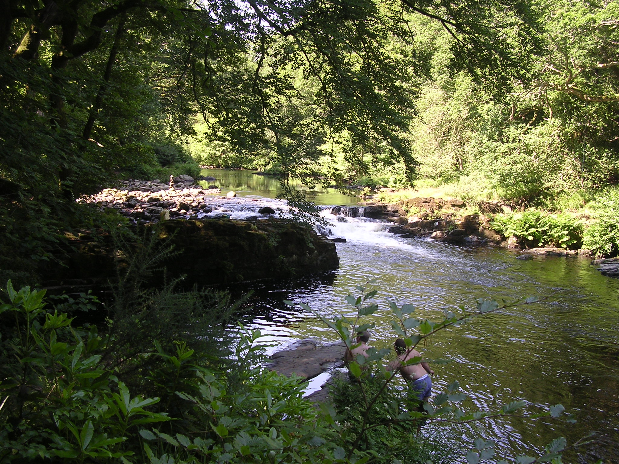
THROUGH KNAPLOCK WOOD ALONG THE EAST BANK OF THE RIVER BARLE PICKING OUR WAY
OVER SLIPPERY TREE ROOTS AND ROCKS. THIS PICTURESQUE RIVER PATH WAS FOLLOWED
NORTHWARDS PASSING, LEA WOOD, PIT WOOD AND OAKBEER WOOD BEFORE it EVENTUALLY
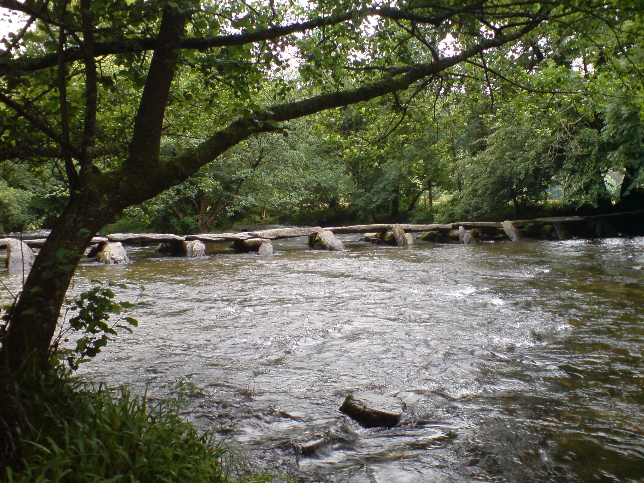
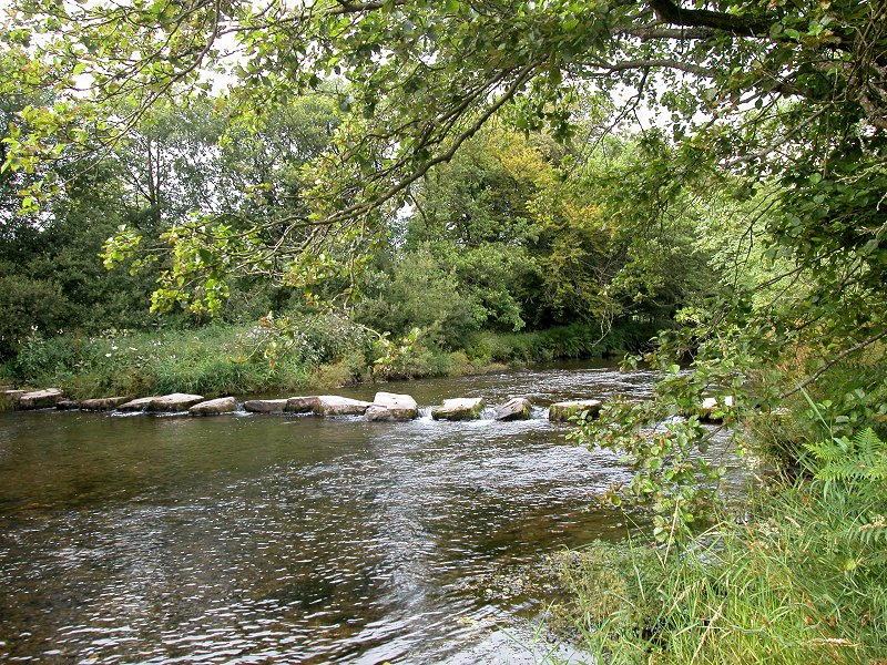
EMERGED INTO SOME WATER MEADOWS where we FOUND THE STEPPING STONES.
WITH THE SUN STILL SHINING SOME TEAM MEMBERS THOUGHT
IT A GOOD IDEA TO POSE ON THE STONES, ONE MEMBER INCLUDING HIS IMPERSONATION OF
'ROCK HUDSON' WHILST STANDING IN THE RIVER.
AFTER THIS BRIEF INTERLUDE WE WERE WALKING AGAIN AND
SOON REACHED UPPINGTON PLANTATION WHERE THE PATH TURNED RIGHT AND UPHILL FROM
THE RIVER TO THE ROAD LEADING INTO WITHYPOOL. AT THE ROAD WE TURNED LEFT AND
WALKED STEEPLY DOWNHILL INTO
WITHYPOOL.
IT DIDN'T TAKE THE ELDEST TEAM MEMBER LONG TO FIND
THE ROYAL OAK
HOTEL AND INSTALL HIMSELF IN THE BAR. BY THE TIME THE REST OF THE
TEAM CAUGHT UP WITH HIM HE HAD A BAR MEAL IN FRONT OF HIM AND LADIES SAT ON
EITHER SIDE. THE REST OF THE TEAM MADE DO WITH A PINT WHILST WAITING FOR HIM TO
FINISH HIS LUNCH AND ENTERTAINING.
EVENTUALLY WE LEFT THE rOYAL OAK AND MADE OUR WAY
DOWN THE ROAD TO
THE POST OFFICE TO SHOP FOR OUR EVENING MEAL AND DAY 3'S BREAKFAST. thankfully,
this POST OFFICE WAS OPEN AND PASTIES,
TINNED PEAS, POTATOES, BACON, EGGS, BREAD AND WINE WERE SUCCESSFULLY PURCHASED. THOSE TEAM MEMBERS WHO MISSED OUT ON THE BAR MEAL (ALL BUT ONE) AT THE
ROYAL OAK MADE USE OF THE tEA ROOMS OPPOSITE TO LUNCH ON VENISON PASTIES AND TEA
AND COFFEE.
NOW FED AND WATERED THE TEAM REJOINED THE TWO MOORS
WAY FOOTPATH HEADING UPHILL TO kITRIDGE LANE. AFTER APPROXIMATELY 600 METRES THE
FOOTPATH EMERGED ONTO THE METALLED ROAD KITERIDGE LANE WHICH WE FOLLOWED
NORTHWEST FOR APPROX 2000 METRES TO LANDACRE LANE. WE CROSSED THE LANE AND
CONTINUED ON THE TWO MOORS WAY FOR ANOTHER 650 METRES BEFORE FORKING RIGHT TOWARDS pickedstones. THIS WAS A DEVIATION FROM THE TWO MOORS WAY NECESSARY TO REACH THE PREARRANGED SITE OF OUR
DAY 2 CAMP.
CONTINUING 1300 METRES IN A WESTERLY DIRECTION WE
CAME TO A JUNCTION WITH A TRACK. HERE WE BRIEFLY STOPPED FOR A WATER BREAK AND A
REST BEFORE TURNING NORTH ONTO THE TRACK HEADING FOR THE B3223 ROAD.
ON REACHING THE ROAD WE TURNED LEFT TOWARDS SIMONSBATH LOOKING FOR THE TURNING ON THE RIGHT WHICH WOULD TAKE US TO wARREN
FARM AND THE SITE OF OUR CAMP. AFTER 1200 METRES WE TURNED RIGHT INTO THE LANE
LEADING TO THE FARM WHICH TOOK US DOWN THREE COMBE HILL TO WARREN BRIDGE A
RATHER SPLENDID SITE FOR OUR CAMP SO WE THOUGHT.
AT WARREN BRIDGE WE PITCHED OUR TENTS IN THE COMBE ON
THE BANKS OF THE THE RIVER EXE AND QUICKLY STARTED PREPARING DINNER AS IT WAS
GONE 17.00 HRS. DINNER WAS TO CONSIST OF HOT PASTIES, BOILED POTATOES AND PEAS
BUT after A
FAILED ATTEMPT AT A HOT ROCKS OVEN WE EVENTUALLY GOT TO EAT SLIGHTLY WARM
PASTIES WITH BOILED POTATOES AND PEAS SALVAGED FROM THE EXPERIMENT. ITS A GOOD
JOB THAT THE TWO BOTTLES OF mERLOT PURCHASED IN WITHYPOOL WERE ON HAND TO DULL
OUR ANGUISH AND DISAPPOINTMENT WITH OUR BELOW STANDARD DINNER.
IT WASN'T UNTIL WE WERE IN THE MIDST OF WASHING our DINNER DISHES IN THE RIVER
EXE THAT WE BECAME AWARE OF THE MIDGES WHICH WERE
BEGINNING TO BITE. AS TIME PROGRESSED THEIR BITING BECAME INTOLERABLE AND THE ONLY
RESPITE TO BE FOUND WAS TO RETIRE TO OUR TENTS AND OUR SLEEPING BAGS. HENCE WE HAD
AN UNPLANNED EARLY NIGHT AND AFTER A LITTLE BANTER ABOUT THE DAYS EVENTS WE
SOMEHOW MANAGED TO GET SOME SLEEP.
DAY 3
OVERNIGHT IT HAD STARTED RAINING HEAVILY AND WE WOKE AT
05.00HRS TO A WET
MORNING AND A PLAGUE OF MIDGES MAKING IT DIFFICULT TO CONCENTRATE ON ANYTHING
BUT TRYING TO AVOID THEIR BITES.
ANY PLANS FOR BREAKFAST WERE QUICKLY ABANDONED AND
CAMP WAS BROKEN UNDER ATTACK FROM THE MIDGES. THEIR BITES WERE VERY APPARENT AND
HAD GIVEN US ALL VARYING APPEARANCES OF SUFFERING FROM THE MEASLES. BEFORE LEAVING IT WAS NECESSARY FOR THE TEAM LEADER
TO RUN THE GAUNTLET OF THE FARMERS DOGS AT WARREN FARM WHILST HE DISPOSED OF OUR
RUBBISH AND PAID OUR CAMP FEES.
WITH WATERPROOFS DONNED WE HURRIEDLY LEFT
WARREN BRIDGE USING INITIALLY THE MACMILLAN WAY WEST HEADING SOUTH STEEPLY UP
THREE COMBE HILL TOWARDS CLOVENROCKS BRIDGE AND THE B3223.
ON REACHING THE B3223 WE TURNED RIGHT AND FOLLOWED IT
DOWNHILL TOWARDS SIMONSBATH. REALISING THAT THE RAIN HAD EASED WE STOPPED IN A CONVENIENT LAY-BY
AND PREPARED AN IMPROMPTU LATE BREAKFAST OF BACON, SAUSAGE AND EGG BUTTIES
WITH HOT BEVERAGES. THE WAIT FOR FOOD PROVED TOO MUCH FOR ONE OF THE TEAM AS HE
WAS VERY SCORNFUL OF
THE TEAM MEMBER SLOWLY BUTTERING BREAD WITH A MICROSCOPIC PEN KNIFE. AFTER A
VERY WELCOME BREAKFAST AND BEFORE HEADING ON OUR WAY BLISTERS WERE ATTENDED TO
AND WATERPROOFS ADJUSTED.
WE ENTERED
SIMONSBATH AT 07.00HRS UNNOTICED AS THERE WAS NOT A SOUL TO BE SEEN. CONTINUING
WE PASSED THE EXMOOR FOREST INN AND LEFT THE VILLAGE ON THE B3358 AND SOON TOOK A FOOTPATH ON OUR RIGHT WHICH
LEAD US ALONG LIME COMBE TO THE SHEEP PENS AND SHEEP DIPS. HERE WITH SKIES
BRIGHTENING AND SUNNY PERIODS DEVELOPING WE PAUSED TO REMOVE OUR WATERPROOFS.
CONTINUING ALONG THIS PATH WE EVENTUALLY REJOINED THE
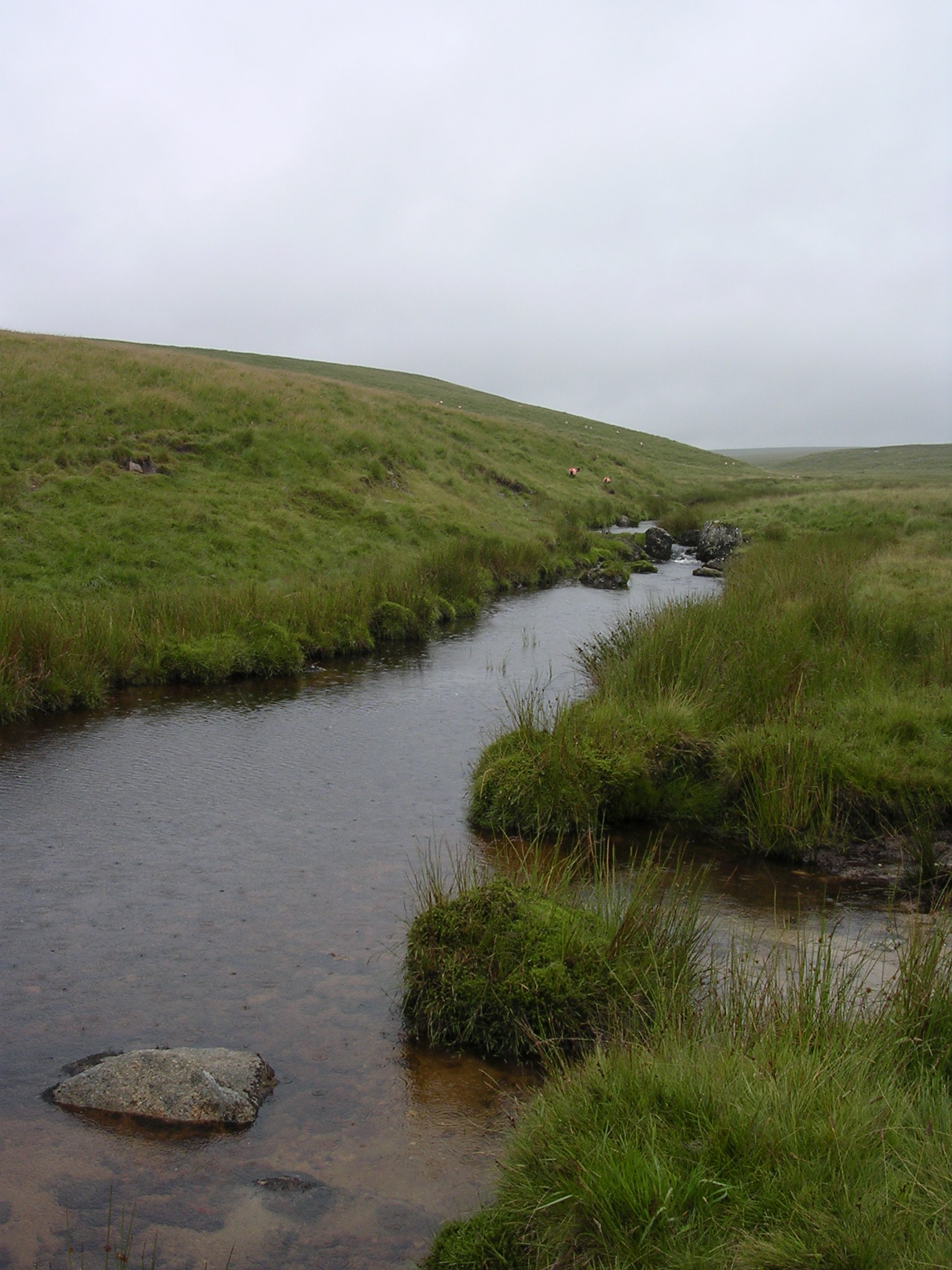
TWO MOORS WAY WHICH WOULD LEAD US ACROSS DURE DOWN TO A VERY BOGGY EXE HEAD (463
METRES) THE SOURCE OF
THE RIVER EXE
.
WHILST CROSSING DURE DOWN WE ENCOUNTERED AN
INQUISITIVE HERD OF CATTLE WHICH THE OLDEST TEAM MEMBER THOUGHT HE WOULD WALK
THROUGH RATHER THAN AROUND. THE CATTLE HAD OTHER IDEAS AND DESPITE HIS
INTIMIDATION REFUSED TO MOVE MAKING IT NECESSARY FOR HIM AND THE TEAM TO BACK DOWN AND TAKE A
ROUTE AROUND THEM.
THE CATTLE BEHIND US WE CONTINUED ALONG THE TWO MOORS
WAY (TARKA TRAIL)
TOWARDS THE HOAR OAK TREE. WITH LONG CHAINS COMBE ON OUR LEFT
WE FOUND A SUITABLE SPOT AT THE FORDS TO REST, GET THE CAMPING STOVE OUT AND PUT
THE KETTLE ON. SORE FEET WERE AGAIN BATHED AND WITH THE SUN NOW SHINING SUN BLOCK
APPLIED TO EXPOSED ARMS AND LEGS BEFORE LEAVING FOR THE HOAR OAK TREE.
AT THE HOAR OAK TREE (IN THE VALLEY ON OUR RIGHT) OUR PATH CROSSED TO
THE RIGHT BANK OF HOAR OAK WATER BEFORE CLIMBING AND HEADING NORTH ALONG THE CHERITON RIDGE (359 METRES) WITH SPLENDID VIEWS ALL THE WAY TO CHERITON AND SCORESDOWN.
APPROACHING CHERITON THE PATH RAN INTO A STONEY TRACK
WHICH EVENTUALLY TOOK US TO A METALLED ROAD. AT THIS JUNCTION WE TURNED LEFT AND
FOLLOWED THE ROAD TO SCORESDOWN. WE LEFT SCORESDOWN HEADING WEST AND THE ROAD
ONCE MORE TURNED INTO A STONEY TRACK WHICH LEAD US TO SMALLCOMBE BRIDGE.
HERE IT WAS NECESSARY TO STOP AND FUSS A VERY
FRIENDLY SMALL DOG AND PASS THE TIME OF DAY WITH ITS OWNERS BEFORE THE TWO MOORS WAY (TARKA TRAIL) ENTERED NATIONAL
TRUST WOODLAND.
WE FOLLOWED THE PATH TO COMBE PARK WOOD CLIMBING ALONG THE WOODED HOAR OAK WATER RIVER VALLEY TO MYRTLEBERRY CLEAVE AND
VIEWED WATERSMEET (THE CONFLUENCE OF HOAR OAK WATER AND EAST LYN RIVERS) ON THE
OPPOSITE SIDE OF THE VALLEY.
THE UNDULATING PATH NOW HEADED WEST ALONG THE
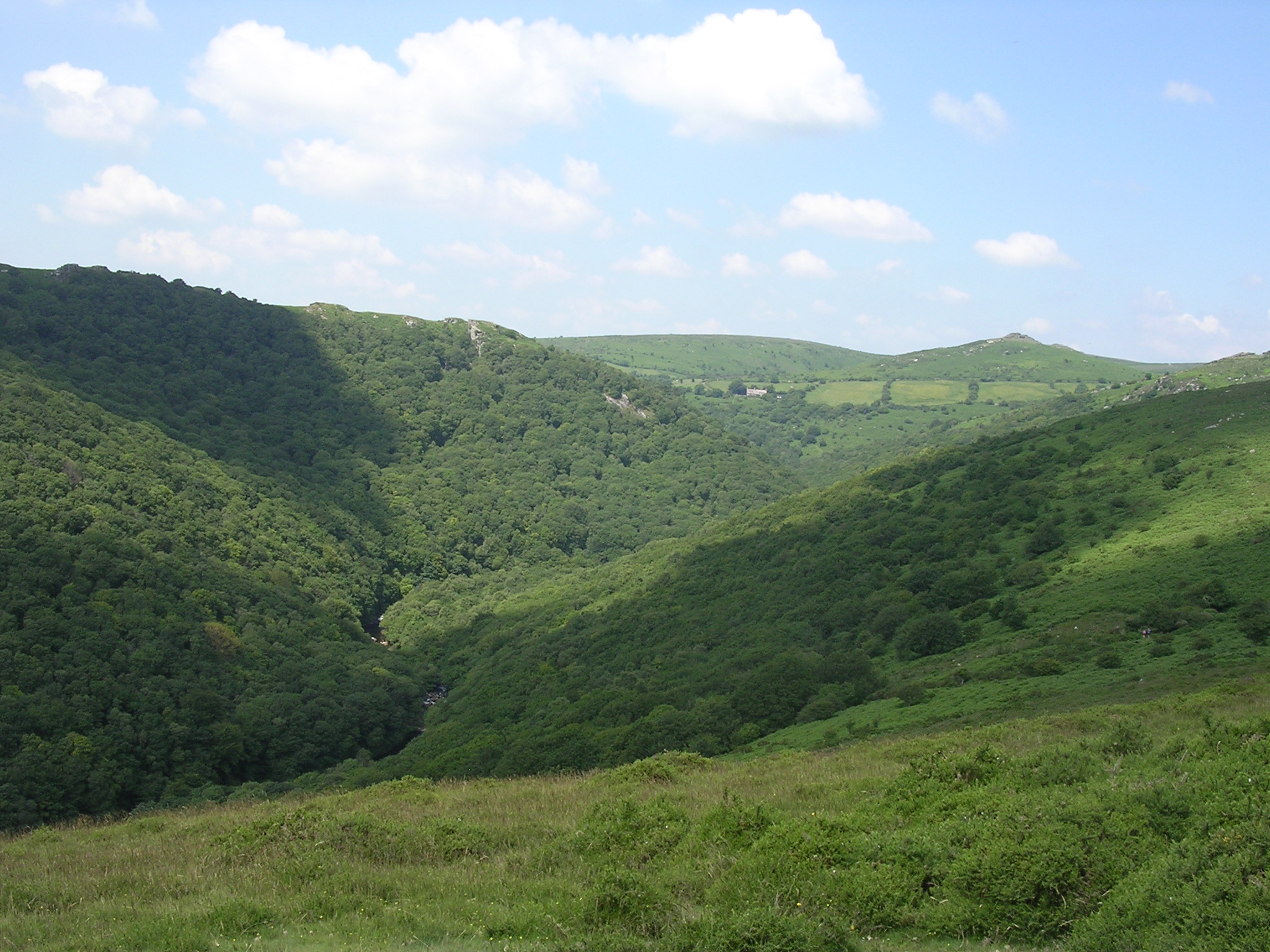
EAST LYN RIVER VALLEY TOWARDS OXEN TOR GIVING
spectacular views over the East Lyn Cleave, other side cleaves, the moorland
fringe and the sea ahead.
WE CONTINUED
ALONG THE TWO MOORS WAY (TARKA
TRAIL)
path signed to Lynmouth AND SOON the wooded dome of Hollerday Hill cAme into
view WITH the town of Lynton sheltering below. AS WE PROGRESSED Lynmouth and its
harbour THEN APPEARED at the foot of the hill DIRECTLY below.
The twists
and turns of the East Lyn RIVER WERE clearly laid out below AND Even at height
the sound of running water COULD be heard from the valley. The path THEN
followed a series of steep hairpins IN ITS DECENT to cross a spring AND then another series back up
again, TAKING US even higher. THE SUNLIT Views into the East Lyn Cleave, river
and road, WERE EXCELLENT from here.
PASSING OXEN TOR
AND GETTING
CLOSER TO THE SEA WE CAME ACROSS A signpost indicating Lynmouth and THE
TWO MOORS WAY
TO OUR RIGHT AND FOLLOWED THIS PATH ON
ITS STEEP NORTH WESTERLY DESCENT THROUGH LYN CLEAVE TO LYNMOUTH.
Superb views
over Lynton and Lynmouth opened out from the path as it descended, sometimes
quite steeply. with the aid of more hairpins It eventually entered
Lynmouth
on a narrow enclosed path Which became steep and slippery.
SOMEHOW DURING THIS DESCENT TEAM MEMBERS
BECAME SEPARATED RESULTING IN THE ELDEST TEAM MEMBER STUMBLING AND FALLING. WITH
ONLY HIS PRIDE INJURED HE DID MAKE IT TO THE END OF THE WALK
UNAIDED AND ALL TEAM MEMBERS WERE SAFELY REUNITED IN THE CAR PARK AT THE BOTTOM
OF THE GLEN LYN GORGE.
At the road
at the bottom the stone erected to commemorate the Two Moors Way opening in 1976 WAS
Observed.
All that was
left now was OUR TRADITIONAL CELEBRATION OF YET another achievement AND after meeting with OUR
LADIES in the car park we set off into lynmouth in search of a suitable eatery.
cHEERS,
mINES A CURRY AND A PINT.
WHERE next!!!
Back To Menu
THE
DARTMOOR WALK 2004
OAKHAMPTON TO MEAVY
AFTER THE INSPIRATIONAL 1999
EAST DARTMOOR WALK LITTLE ENCOURAGEMENT WAS NEEDED TO RETURN TO DARTMOOR
FOR ANOTHER ADVENTURE. FEELING BETTER PREPARED THAN IN 1999 AND AFTER SOME
DELIBERATION THE TEAM OF SIX DECIDED TO TACKLE A WEST DARTMOOR ROUTE
STARTING IN OAKHAMPTON AND ENDING IN MEAVY.
DAY 1
AFTER SOME INITIAL 'TACKLE
TROUBLE' SUFFERED BY THE ELDEST MEMBER OF THE TEAM THE WALK STARTED IN
SUNSHINE AT 12.15PM ON A FRIDAY AFTERNOON. WE HEADED WEST ALONG TORS ROAD TO THE FOOTPATH THAT
RUNS THROUGH
OAKHAMPTON GOLF COURSE. LEAVING THE LADIES BEHIND AND WITH
ONLY SOME DARTMOOR PONIES AND CONFUSED GOLFERS FOR COMPANY WE SET OFF TO REACH THE ROAD BRIDGE WHICH CROSSES THE A30.
HAVING CROSSED THE
A30 WE TOOK THE FOOTPATH UPHILL INTO MELDON WOODS TOWARDS THE
MELDON VIADUCT.
SHORTLY BEFORE REACHING THE VIADUCT
ONE MEMBER OF THE TEAM (WHO SHALL REMAIN NAMELESS) DISCOVERED
THAT THEY HAD LOST THEIR NEW WALKING HAT AND NEEDED TO RETRACE THE ROUTE
TO FIND IT, NOT A GOOD START !!!
EVENTUALLY THE TEAM
ARRIVED AT THE VIADUCT AND TOOK THE OPPORTUNITY TO EXPLORE THE NEARBY
RAILWAY PARAPHERNALIA AND VIEW
MELDON RESERVOIR DAM.
HEADING WEST
WE CROSSED THE VIADUCT ON THE GRANITE WAY TOWARDS SOURTON. AT THE
JUNCTION OF THE ROAD TO PREWLEY WATER WORKS WE LEFT THE GRANITE WAY AND
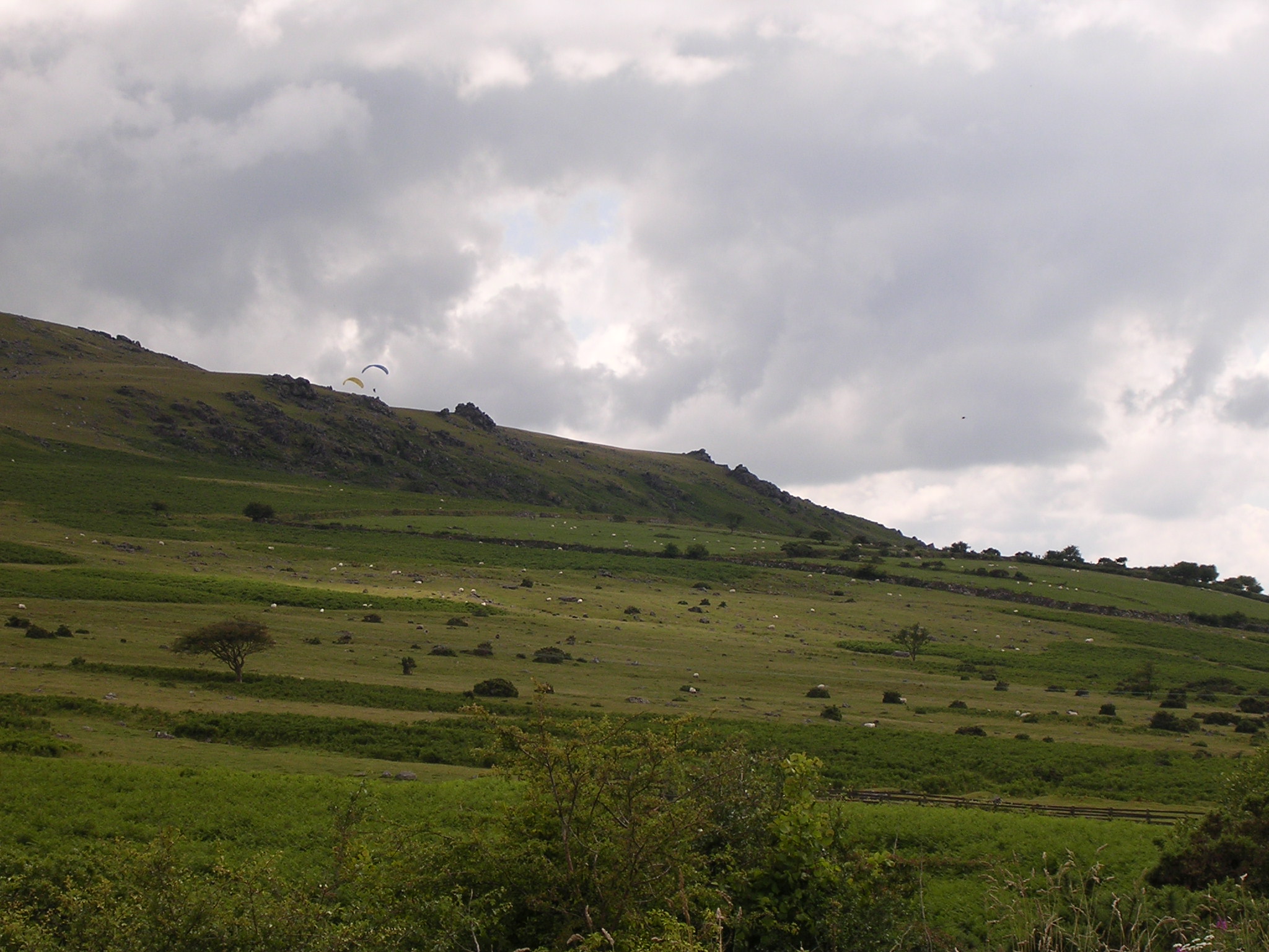
STARTED CLIMBING LEFT TO SOURTON TORS (440 METRES) WHILST OBSERVING A
GROUP OF PARAGLIDERS TAKING FULL ADVANTAGE OF THE HEIGHT AND PREVAILING
WINDS TO ACHIEVE THEIR POWERLESS FLIGHT.
ON REACHING THE TOR
WE RESTED ADMIRING THE VIEW WHILE IDENTIFYING OUR NEXT WAYPOINT TO THE
SOUTH, GREAT NODDEN. THE OPPORTUNITY WAS ALSO TAKEN FOR A BREW,
SOME REFRESHMENTS AND TO FINALISE THE SITE FOR OUR OVERNIGHT CAMP.
THE TEAM LEADER CONVINCED US ALL THAT HE HAD ALREADY IDENTIFIED A WONDERFUL, SCENIC SITE AT THE WHEAL JEWEL RESERVOIR.
HAVING RESTED AND
REFUELLED WE MADE OUR WAY SOUTH TRAVERSING LAKE DOWN, SOUTHERLY DOWN AND AFTER PASSING A LOGAN STONE TO OUR LEFT
REACHED GREAT NODDEN (436
METRES).
BECAUSE OF THE
POSSIBILITY OF LIVE FIRING AT THE WILLSWORTHY ARTILLERY RANGES IT WAS
THOUGHT A GOOD IDEA TO LEAVE THE MOOR SOONER RATHER THAN LATER. SO, WE TOOK THE TRACK TO NODDEN GATE AND FOOTPATH ACROSS VALE DOWN
BEFORE TURNING RIGHT ONTO THE TRACK LEADING TO THE A386 ROAD IN LYDFORD. DURING THIS SECTION OF THE WALK WE WERE LUCKY ENOUGH TO STUMBLE
UPON SOME MUSHROOMS WHICH WERE PICKED AND CAREFULLY STORED FOR
INCLUSION IN THE MENU FOR OUR DAY 1 CAMP EVENING MEAL.
DURING THE WALK
THROUGH LYDFORD AND ALONG THE A386 WE PASSED THE DARTMOOR INN, OH FOR A
REFRESHING PINT, BUT UNFORTUNATELY IT WAS CLOSED.
CONTINUING SOUTH ON
THE A386 WE EVENTUALLY PASSED WILLSWORTHY CAMP AND THANKFULLY REACHED
OUR POINT OF DEPARTURE FROM THE ROAD, A FOOTPATH ON THE LEFT WHICH
HEADED TO THE WHEAL JEWEL RESERVOIR THE SITE OF OUR DAY 1 CAMP. ON THE
CLIMB TO OUR CAMP SITE WE WERE ACCOMPANIED BY SWALLOWS FLYING AT KNEE
HEIGHT WHICH WERE FEEDING ON THE INSECTS THAT WE WERE DISTURBING FROM
THE LONG GRASS AS WE WALKED.
AT LAST! WE ARRIVED
AT THE RESERVOIR, BUT WHERE WAS THE
WONDERFUL AND SCENIC CAMP SITE. IT BECAME APPARENT THAT THE RESERVOIR WAS BUILT ON
THE SITE OF A PREVIOUS TIN MINE.
AT 18.00HRS WE WEARILY PITCHED
OUR TENTS AND MADE CAMP ANTICIPATING OUR EVENING MEAL OF SAUSAGES, PORK CHOPS,
MUSHROOMS AND PASTA SHELLS IN A SAVOURY SAUCE. RICE PUDDING WITH RAISINS AND JAM AND HOT BEVERAGES
COMPLETED THE MEAL. WHILST COOKING THE MEAL IT
WAS DISCOVERED THAT ONE MEMBER OF THE TEAM (THE SAME TEAM MEMBER THAT
HAD EARLIER LOST HIS WALKING HAT) HAD 'BORROWED' HIS PARTNERS
BEST FRYING PAN WITHOUT PERMISSION FOR USE DURING THE WALK.
AFTER EATING,
WASHING UP AND A TOUR OF THE RESERVOIR THE SUN WAS NOW CASTING LONG
SHADOWS OVER THE CAMP SITE SO WE RETIRED TO OUR TENTS FOR A WELL EARNED
SLEEP.
IT WASN'T LONG
BEFORE THE PEACE WAS SHATTERED BY GUN AND ARTILLERY FIRE WHICH LASTED
WELL INTO THE NIGHT. HOW LONG I COULDN'T SAY AS I EVENTUALLY FELL ASLEEP
BUT IT BROUGHT A WHOLE NEW MEANING TO THE EXPRESSION 'GETTING YOUR HEAD
DOWN'.
DURING THE NIGHT IT WAS NECESSARY FOR ME TO ANSWER A CALL OF NATURE. ON LEAVING
THE TENT I FOUND THAT THE MOON WAS SHINING BRIGHTLY AND A WAIST HIGH
MIST WAS COVERING THE GROUND. I CAREFULLY WADED THROUGH THE MIST TO THE DESIGNATED TOILETING AREA AND EERILY FOUND ANOTHER 'LEGLESS' TEAM
MEMBER ANSWERING A SIMILAR CALL, QUITE A HAUNTING EXPERIENCE.
DAY 2
AFTER A SOMEWHAT SLEEPLESS
NIGHT THE TEAM MEMBERS WERE RELUCTANT TO LEAVE THE COMFORT OF THEIR
SLEEPING BAGS BUT AFTER SOME INTER TENT BANTER WE WERE ALL ON PARADE BY 7.00AM AND PREPARING
BREAKFAST.
CLOUDS WERE GATHERING WHILST
WE ATE BREAKFAST OF BACON AND EGG (CAREFULLY COOKED IN THE 'BORROWED' FRYING
PAN ) AND PLACED IN BUTTIES. BY 8.30AM WE HAD BROKEN CAMP.
FROM THE RESERVOIR WE HEADED
SOUTH DOWN THE TRACK TO THE HAMLET OF ZOARE AND TURNED LEFT ONTO A METALLED ROAD.
THIS ROAD WAS FOLLOWED TO
WILLSWORTHY AND BY NOW IT HAD STARTED RAINING MAKING A BRIEF STOP
NECESSARY IN ORDER TO DON WATERPROOFS.
ON REACHING WILLSWORTHY A
RIGHT TURN WAS MADE TOWARDS LANE END . HERE WITH THE RAIN RATE INCREASING WE
IMMEDIATELY TOOK A RIGHT TURN ONTO A FOOTPATH LEADING TO A WOODEN FOOTBRIDGE
BY WHICH WE CROSSED THE RIVER TAVY.
ONCE ACROSS THE BRIDGE WE
MADE TOWARDS BROUSENTOR FARM AND PASSING THE FARM ON OUR RIGHT WE CONTINUED TOWARDS
COCKS HILL (501 METRES) ENTERING IN THE PROCESS MERRIVALE RANGE (NO RED FLAGS
FLYING).
BY NOW THE ELDEST MEMBER OF
THE TEAM WAS STRUGGLING AND FALLING BEHIND. SO, ON COCKS HILL WITH ONLY DARTMOOR
PONIES FOR COMPANY IT WAS NECESSARY TO HUDDLE TOGETHER
LIKE ANIMALS TO BRAVE THE EXTREMELY WET WEATHER WHILST WAITING FOR THE DETACHED
TEAM MEMBER TO REJOIN THE TEAM.
AGAIN A COMPLETE TEAM
WE WALKED ON TOWARDS BLACK DUNGHILL (492 METRES) STOPPING ON THE BANK OF PRISON LEAT
FOR HOT DRINKS AND SNACKS IN AN ATTEMPT TO LIFT OUR SPIRITS. IT WAS ALSO
ESTABLISHED THAT A TRIP INTO PRINCETOWN WOULD BE NECESSARY TO SHOP FOR PROVISIONS
FOR OUR EVENING MEAL.
AT BLACK DUNGHILL WE TURNED
TOWARDS HOLMING BEAM WHERE WE TOOK THE METALLED TRACK TO THE B3357.
TURNING LEFT WE ALMOST
IMMEDIATELY TOOK A FOOTPATH ON THE RIGHT WHICH LEAD US TO THE B3212 ROAD TO PRINCETOWN.
WITH THE RAIN EASING WE TOOK
A RIGHT TURN AT THE END OF THE FOOTPATH AND JOINED THE B3212 AND FOLLOWED IT
INTO PRINCETOWN.
UNFORTUNATELY SHOPPING FOR
PROVISIONS IN
PRINCETOWN PROVED FRUITLESS AND LEFT US NO ALTERNATIVE OTHER THAN
TO VISIT THE PLUME AND FEATHERS. HERE SURPRISE, SURPRISE THEY HAD AN EXTENSIVE
BAR MENU, SOME EXCELLENT
JAIL ALE AND A WELCOMING OPEN FIRE. WE WERE ABLE
TO REMOVE OUR WATERPROOFS AND WERE COMPELLED
TO SAMPLE THE BAR FOOD AND JAIL ALE WHILST ATTEMPTING TO DRY OURSELVES AND OUR
CLOTHES AFTER A WET MORNINGS WALKING.
WELL FED AND WATERED AND
SOMEWHAT DRIER THAN WE WERE WE RELUCTANTLY LEFT THE PLUME AND FEATHERS LATE
AFTERNOON AND JOINED THE ADJACENT FOOTPATH TO HEAD SOUTH TOWARDS WHITEWORKS. THE PREVIOUSLY
STRUGGLING MEMBER OF THE TEAM WAS SOON AHEAD AND OUT OF SIGHT,
SOMETHING WE ATTRIBUTED TO THE JAIL ALE WHICH FROM THEN ON WAS REFERRED TO AS
ROCKET FUEL.
AFTER SEVERAL KILOMETRES
WALKING WE TURNED RIGHT AND TOOK THE FOOTPATH TOWARDS BURRATOR WHICH
PASSED
CRAZY WELL POOL
THE PLANNED SITE OF OUR DAY 2 CAMP.
BY THE TIME WE REACHED OUR
PLANNED CAMP SITE THE SUN WAS SHINING. CAMP WAS SET IN GLORIOUS SUNSHINE AND
ADVANTAGE WAS TAKEN TO FURTHER DRY OURSELVES AND OUR KIT WHILST PREPARATIONS WERE
MADE FOR A LIGHT EVENING MEAL.
AFTER SOME CONVERSATION WITH
PASSING HORSE RIDERS WE EXPLORED THE AREA AROUND THE POOL BEFORE PREPARING
FOR AN EARLY NIGHT.
ALL SLEPT SOUNDLY AFTER
AN ARDUOUS DAYS WALKING IN ATROCIOUS CONDITIONS AND WOKE TO FAIR WEATHER.
DAY 3
TODAY WOULD BE OUT OUR LAST
DAY ON THE MOOR AND WITH ONLY A RELATIVELY SHORT WALK TO MEAVY LEFT TO COMPLETE
THE TEAM HAD A LIE IN BEFORE PREPARING BREAKFAST.
BREAKFAST CONSISTED OF BACON
AND EGG (AGAIN CAREFULLY COOKED IN THE 'BORROWED' FRYING PAN) AND PLACED IN BUTTIES AND THE
REMNANTS OF FOOD CARRIED WITH US FROM OAKHAMPTON.
BY 9.00AM WE HAD BROKEN CAMP
AND WERE HEADING BACK TO THE WHITEWORKS TO BURRATOR FOOTPATH IN SUNSHINE WITH A
SPRING IN OUR STEP.
AT THE FOOTPATH WE TURNED
RIGHT TOWARDS BURRATOR AND WALKED DOWNHILL BETWEEN DOWN TOR (366METRES) ON
OUR LEFT AND LEATHER TOR (370 METRES) ON OUR RIGHT.
EVENTUALLY WE PASSED
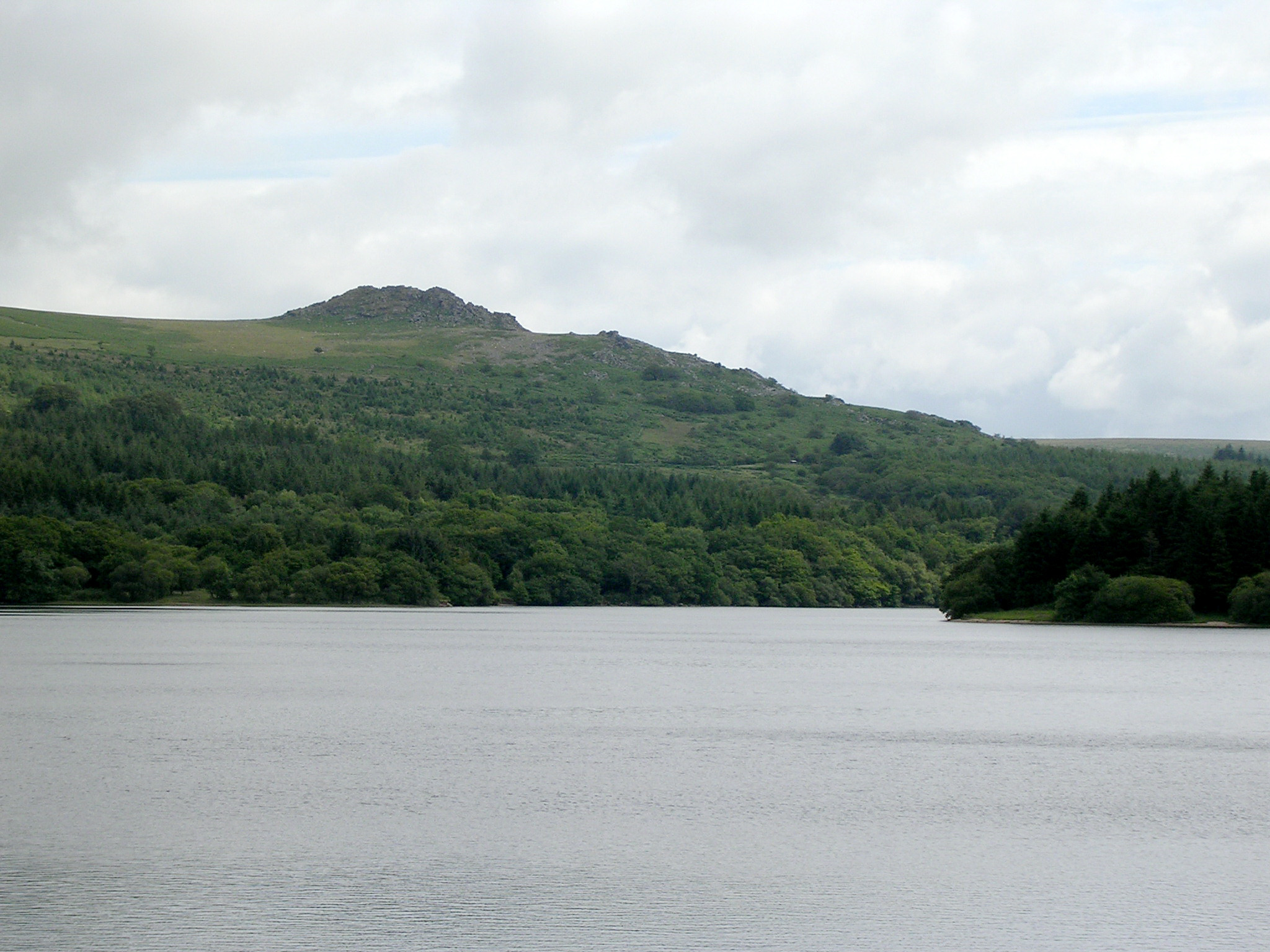
BURRATOR RESERVOIR ON OUR RIGHT AND CONTINUED ONWARDS TO OUR
DESTINATION OF MEAVY.
ON REACHING
MEAVY A WELL
DESERVED CELEBRATION WITH THE LADIES WAS FELT NECESSARY AND WHERE BETTER TO DO
THIS THAN AT THE ROYAL OAK. IT WAS SOON ESTABLISHED THAT THE LADIES WERE STILL
IN
BODMIN
CONCLUDING THEIR WEEKEND STAY THERE WITH A VISIT TO
LANHYDROCK HOUSE AND GARDENS. SO, WITH NO ALTERNATIVE (AS THEY WERE OUR TRANSPORT HOME) WE
STARTED OUR CELEBRATION WITHOUT THEM.
IN DUE COURSE THE LADIES
ARRIVED AND JOINED US FOR LUNCH AND ANOTHER PINT OF 'ROCKET FUEL'.
Back To Menu
THE
DARTMOOR WALK 2005
SOUTH BRENT TO DREWSTEIGNTON
With
two previous excursions to Dartmoor under our
belts this third walk was undertaken with little thought other than how
our aging bodies would cope. On this occasion a route to the east side
of the moor was agreed by the team, starting from South Brent with the
intended destination of The Anglers Rest, Drewsteignton.
DAY 1
After a picnic lunch with
our ladies we left
them (and a dog which befriended us at our point of departure) in sunshine at
1.00pm.
Heading north on a metalled road / footpath
we uneventfully passed Lutton and Didworthy before arriving at
Shipley Bridge, After a brief stop to explore the river (where we saw a Dipper)
we continued north on the track to
the Avon Dam Reservoir.
At the reservoir we met a lady walking her
dogs who was convinced she had previously met our team leader, something he
adamantly denied but the rest of the team were not so sure.
Still heading north we continued to the
Abbotts Way where we took the path east to Water Oar Corner. Here we left the
Abbotts Way and turned north west along boundary works to join the Two Moors
Way.
Heading north east on the Two Moors Way we
set out for Chalk Ford the site of our day 1 camp.
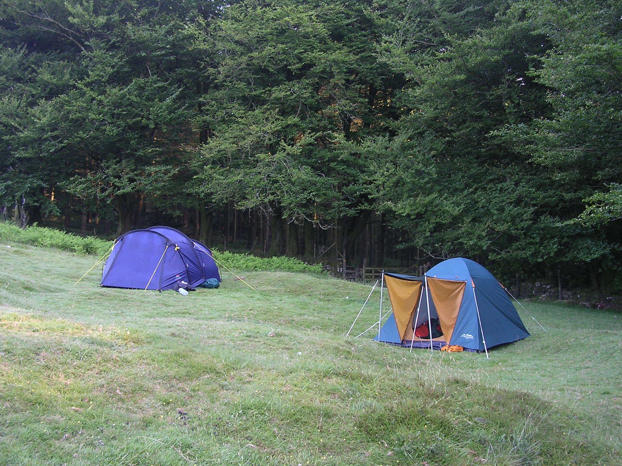
We pitched tents at 6.00pm and immediately
gathered kindling wood and lit a fire on the shingle bank of the River Mardle.
It wasn't long before our stomachs were complaining and food was on our minds.
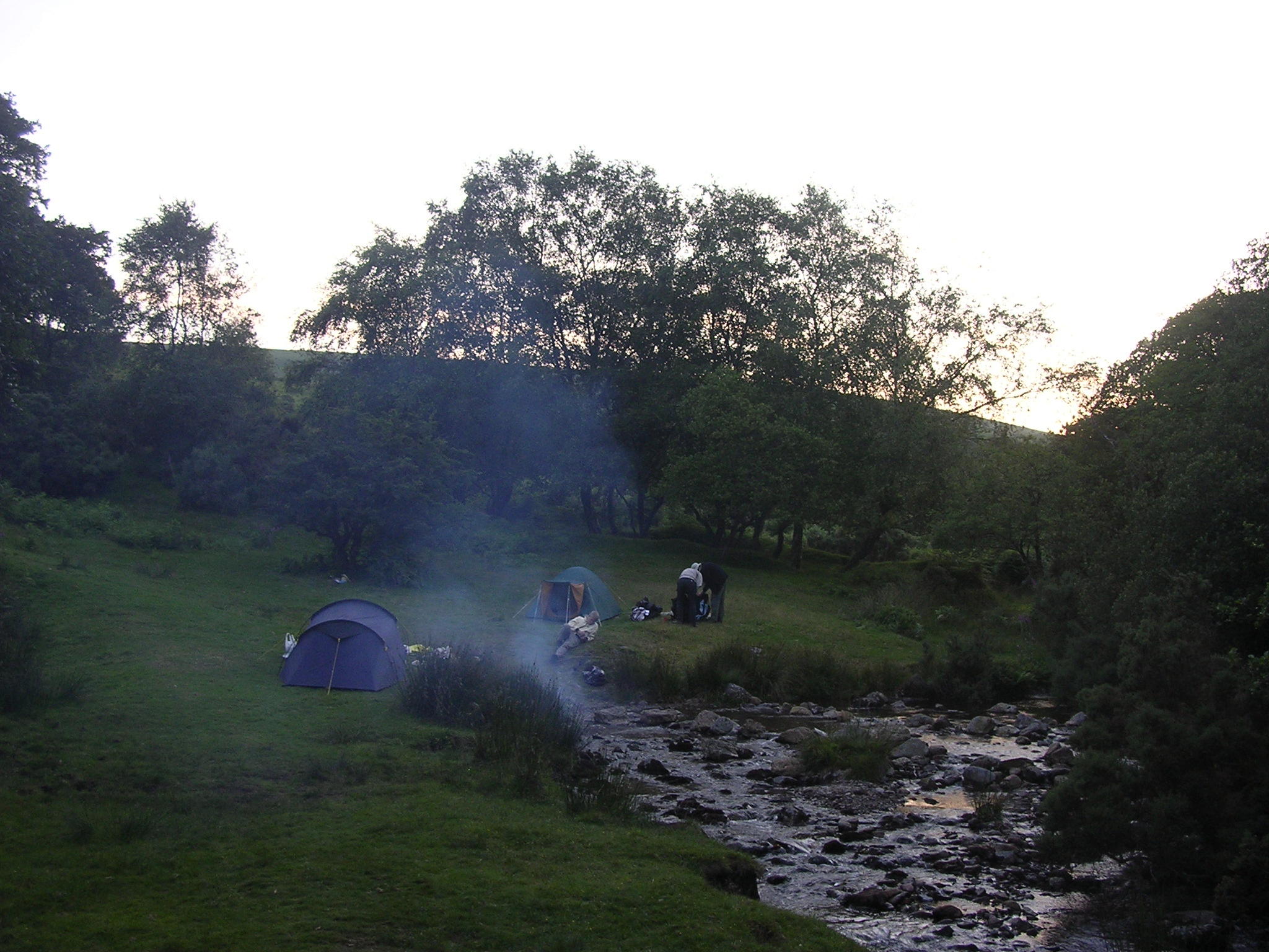
Dinner comprised pork chops, savoury rice,
mange tout and mushrooms followed by rice pudding with raisins and hot drinks.
There was a surprise in that cans of beer
had been secretly carried by the youngest team member. These were consumed with
relish whilst sitting around the camp fire before washing up.
By this time the light was fading and our
thoughts were of turning in and a well earned rest.
It wasn't until we had retired to our tents
that we realised how noisy the babbling of the water over the ford in the River
Mardle was and the effect it had on our bladders.
Eventually tiredness and sleep overcame us
all.
DAY 2
Soon dawn was breaking and sunshine was
flooding our tents.
By 7.00am we were up and about and breakfast
preparations were well underway.
No bacon (somebody, they know who, had left
it at home in the fridge) to go with the eggs but the sausages meant for dinner
made an excellent substitute and this time breakfast was cooked legitimately in
'the frying pan'.
After hot drinks we broke
camp ensuring that the fire was extinguished and all that wE left were our footprints. It was
8.30am and we were on the move down Green Lane heading for Scorriton.
With clear skies the temperature was rising
quickly, it was going to be a scorcher. By the time we reached the Tradesman's
Arms it was necessary to stop and remove unnecessary clothing in order to stay
cool.
Fortunately the pub was closed and there was
no obstacle to leaving Scorriton as we headed east before turning north along
the Dartmoor Way towards
Holne.
Here it was hoped to re-provision and replace the
missing bacon and the consumed sausages meant for day 2 camp's dinner.
According to our team leader
there was a Post Office here but on arriving we discovered from locals that it
had closed a couple of years ago and that the team leaders OS map was several
years out of date.
(DOES THIS SOUND FAMILIAR - THE TEAM
LEADER SEEMS TO HAVE A KNACK OF FINDING NON-EXISTENT POST OFFICES).
So, We took advantage of civilisation and the hospitality of one
of the locals to refill our water bottles which had prematurely been emptied due
to our need to keep hydrated in the heat and left Holne heading north along the
Dartmoor Way towards
New Bridge following the River Dart. To stay cool it was
thought a good idea by some of the team to bathe in the river at Horseshoe Falls.
It turned out to be not such a good idea for one of the team who in the course
of bathing lost his underpants making it necessary for a discrete exit
from the water so as to hide his embarrassment and avoid frightening the public using
the nearby footpath.
It was 10.30am before we had finished bathing
and the team continued
to New Bridge. Here at the car park we encountered an ice cream van which with
the temperature ALREADY in the 80's could not be ignored. The earlier embarrassed team
member duly treated the team to a '99 ice cream' each.
The walk was rapidly turning into a holiday
and the team leader found it necessary to exercise his authority and insist on a
serious effort to reach our planned day 2 camp site.
We left the car park crossing the bridge and
headed along the road to Ashburton. Soon we took a left turn onto a footpath walking steeply
uphill to
Leigh Tor
(176 metres) before heading west to re-join the Dartmoor Way and on to
skirt Aish Tor (283 metres).
Following Dr. Blackall's Drive north west we
joined the Two Moor Way which we would follow to Widecombe In The Moor where we
hoped to re-provision as our attempt at Holne was fruitless.
Passing Mel Tor (346 metres) it was
midday and with
wonderful views of the Dart Valley on our left and Bel Tor (354 metres) on our
right we crossed Sherberton Common and continued to Lock's Gate Cross.
Here we turned left on a metalled road into
Ponsworthy and after leaving Ponsworthy behind and still following the Two Moors Way we
headed north following
the West Webburn River to Jordan.
Continuing north we reached Dockwell and
soon forked right on Dunstone Down passing Wind Tor (375 metres) to take the
Eastern Route of the Two Moors Way.
The track ran into a metalled road which
steeply descended to Southcombe. Here we met a large group of young walkers from
Harringay, London. They were resting and seeking respite from the heat which was beginning to have an effect on us all.
We exchanged pleasantries
and after some banter we continued to the 'T' junction at the Widecombe In The Moor to Ponsworthy road.
At the junction we turned left and walked
into
Widecombe In The Moor.
By now it was 2.30pm.
First stop was a local shop where we purchased cold drinks in an
attempt to combat the effects of the heat and local pasties to replace our spent
energies.
Given the heat, lack of stamina of some team members and our
progress which was beginning to fall behind schedule the leader called a team
meeting to discus the plan for the remainder of the walk.
With little food remaining in our back packs for day 2 camps
dinner and little choice in the few shops that were open to re-provision it was
decided to eat dinner early at
the OLD Inn,
Widecombe In The Moor
before heading further north to our day
2 camp site.
By
coincidence there was a gathering of World War 2 military vehicles and their
accompanying aptly dressed personnel both Allied and German taking place. Their meeting place after their procession through Widecombe In The Moor was the
rather large OLD Inn car park.
So, dinner was eaten in the pub garden accompanied by a medley of Vera Lynn and
Marlene Dietrich songs.
During the course of dinner it was decided that due to our
unplanned diversion into Widecombe In The Moor a deviation from our planned
route was necessary to avoid a steep climb to re-join the Two Moors Way Central
Route.
Feeling a little refreshed after our meal and entertainment we left the Inn and
took the left turn to follow the metalled road leading to Heathercombe.
instead of taking the steep footpath on our left to
Kingshead and the Two Moors
Way Central Route we stayed on the metalled road to follow the Eastern Route.
Passing Wooder Manor on our left we continued through Pittpark, Isaford, West
Lodge, Ley, Lower and Middle Natsworthy and Natsworthy before finding a suitable
site to camp.
To the left of the road we chose a perfect spot on
Hamel Down close to the East Webburn River and pitched our tents at 6.00pm. We lit a camp fire not
realizing that we were not alone until we heard the sound of live music.
We were considering finding an alternative site until a couple of attractive
ladies from the gathering responsible for the music visited our camp and invited
us to join them for strawberries and cream with champagne explaining that they
would be leaving their site before darkness fell.
To the annoyance of the majority of the team, one member (idiot,
and owner of 'the frying pan') politely
declined the invitation. this he would not be allowed to forget for the
remainder of the walk.
After exploring the East Webburn River, Berry Pound and the Blue Jug boundary
stone we returned to camp and ate our meagre rations whilst reflecting on the
days events.
Light was fading fast and after a long hot days walking we were all extremely tired
and looking forward to some sleep SO we retired to our tents.
No sooner than we had drifted into sleep it was broken by the hooting of a very
loud and close Tawny Owl which had perched in a nearby tree.
After what seemed an eternity the hooting cease, peace was restored and sleep
was possible again.
DAY
3
We
rose early with the intention of an early start to minimize the amount of
walking in the hot conditions.
By
7.00pm breakfast was done and dusted, camp had been broken and we were heading
north on the Two Moors Way Eastern Route through the wood adjacent our camp site
towards Kendon via Heathercombe.
Later on route to Lower HookneR we encountered a lamb which had its head trapped
in a wire fence alongside the footpath. Realising its plight the earlier
embarrassed member of the team had soon extricated its head from the fence and Once
free it soon returned to its flock with no ill effect.
On
reaching Lower HookneR the team thought it prudent to top up our water bottles
thus ensuring our hydration in what was becoming a another very hot day. Fortunately we
encountered a lady in her garden who exchanged greetings, took pity on us
and invited us into her house for a glass of orange squash and TO SAMPLE one of her
freshly baked cakes.
Suitably fed and watered and with our water bottles full
we thanked the lady
and bid her and her husband farewell to continue on our journey.
It
wasn't long before the team leader discovered an error in his map reading making
it necessary to divert off of the Two Moors Way Eastern Route and head east
following a footpath to Langdon. We eventually met a metalled road and climbed
the hill towards Langdon and with Easdon Tor (439 metres) on our right we travelled
the road observing the Manor House Hotel and golf course in the valley to our
left.
Following the road through Olde Yarde we headed to meet the road which would
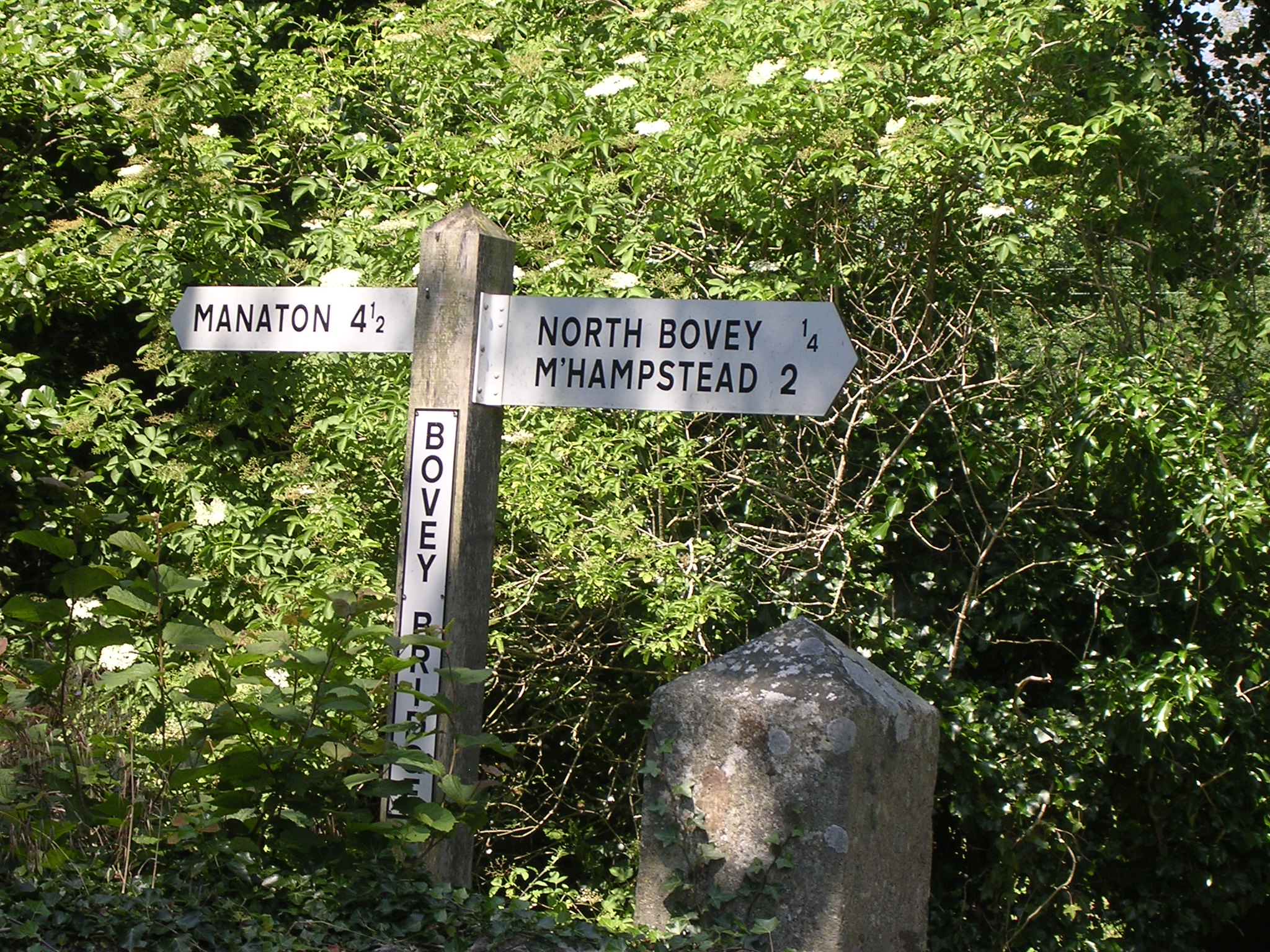
take us to North Bovey. It was now becoming apparent that our progress was not
as planned and with the heat our plan to reach Drewsteignton and the
Anglers Rest would not be achieved. Disappointment for some and relief for
others but all were in agreement that
North Bovey would be a convenient end to
the walk.
The revised arrangements were communicated to our ladies (our transport home)
who were still in Paignton (after an excursion on the River Dart) concluding
their weekend stay there with a visit to the zoo.
Now, with some time to fill before meeting the ladies we took the opportunity to
explore and it wasn't long before we found water in the form of the River Bovey.
Some team members thought it would be refreshing in the heat of the day to AGAIN strip
to their underpants and bathe in the river. I have photographic evidence but am
forbidden to publish it.
Once dry and properly dressed we continued our exploration and stumbled upon
The
Ring of Bells Inn before returning to the Village Green to await the arrival of
our transport home. Whilst waiting all were in agreement that we should not
depart without our customary end of walk celebratory drink and meal with our
ladies and where better to do that than at The Ring of Bells Inn.
Cheers, here's to the next walk.
COMING SOON "ESCAPE TO EXMOOR"
Back To Menu
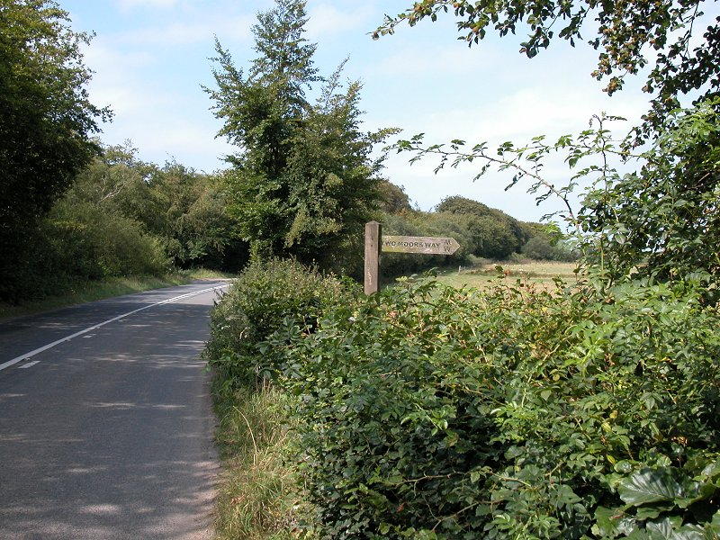
Kingston Seymour Seawall, NORTH SOMERSET.
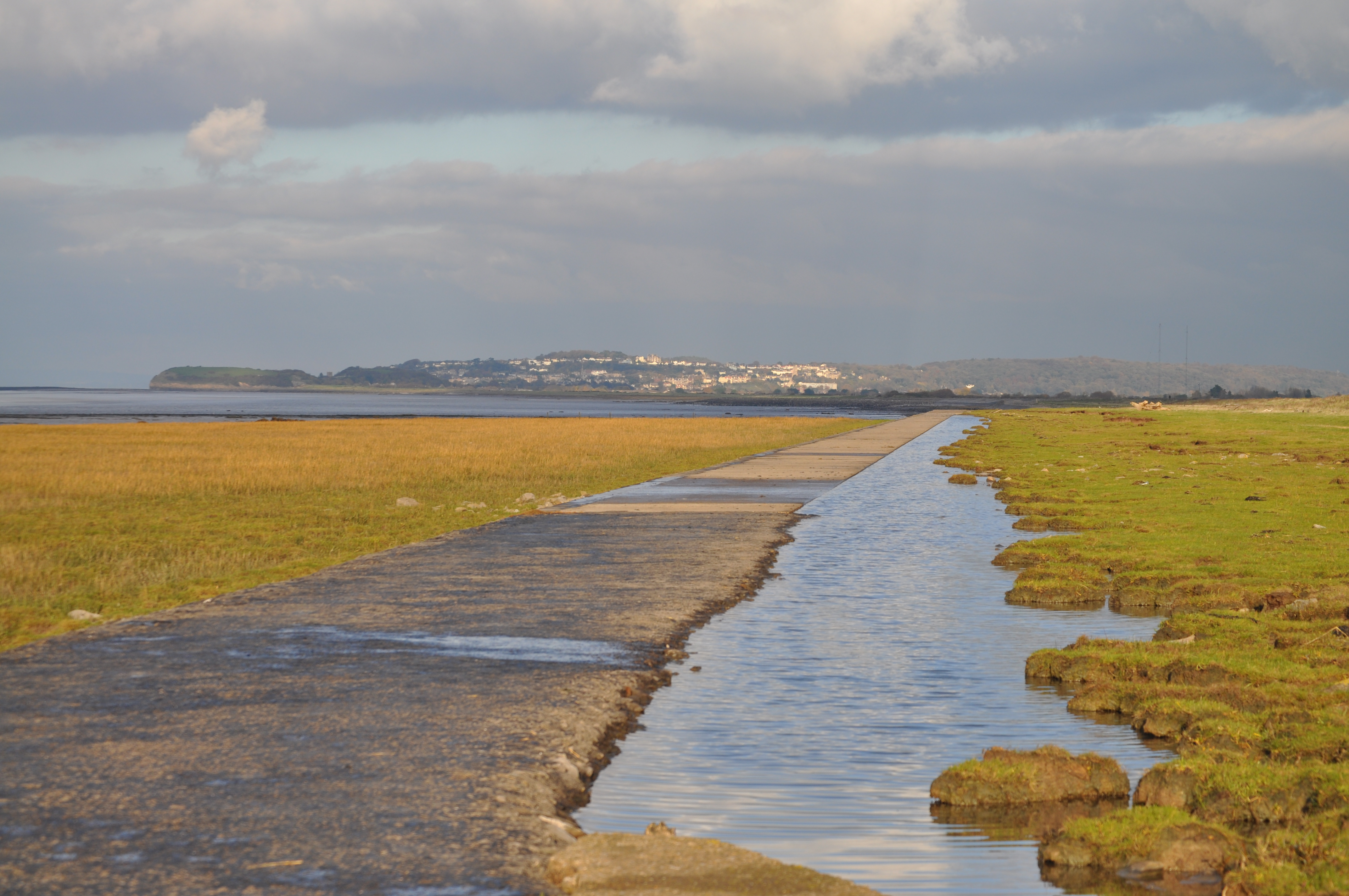
A WALK ALONG THE COAST
Start at Channel View Farm, Middle Lane, Kingston Seymour, NORTH
SOMERSET.
OS MAP 153 WESTON-SUPER-MARE AND BLEADON HILL. BURNHAM ON SEA AND
CLEVEDON ST 383 677.
FLAT WALKS, THE
Short Walk 2.0km, THE Long walk 5.4km.
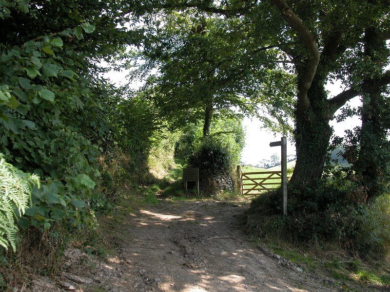
Enter the wide stony track off
the right angled bend in the road between Channel View Farm and the
bungalow. Go through a gap in the hedge immediately to the left of the
metal farm gate. Follow this track for approx 250 metres until another
metal farm gate is reached.
CROSS
the stile to the right of this gate and follow the gravel / stone track
which turns almost immediately right for approx 300 metres until another
metal farm gate is reached which has a cattle grid to the left of it.
Go
through this gate and straight ahead and up the incline for approx 25
metres to reach the sea wall.
Here you have a choice. Go left for a short walK OF 400 METRES along the
sea defences to Hook's Ear.
Go right for a longer walk OF 2100 METRES along the sea defences to the
mouth of the Congresbury River Yeo.
If you choose to go right after Approximately 600 metres cross a stile in a fence
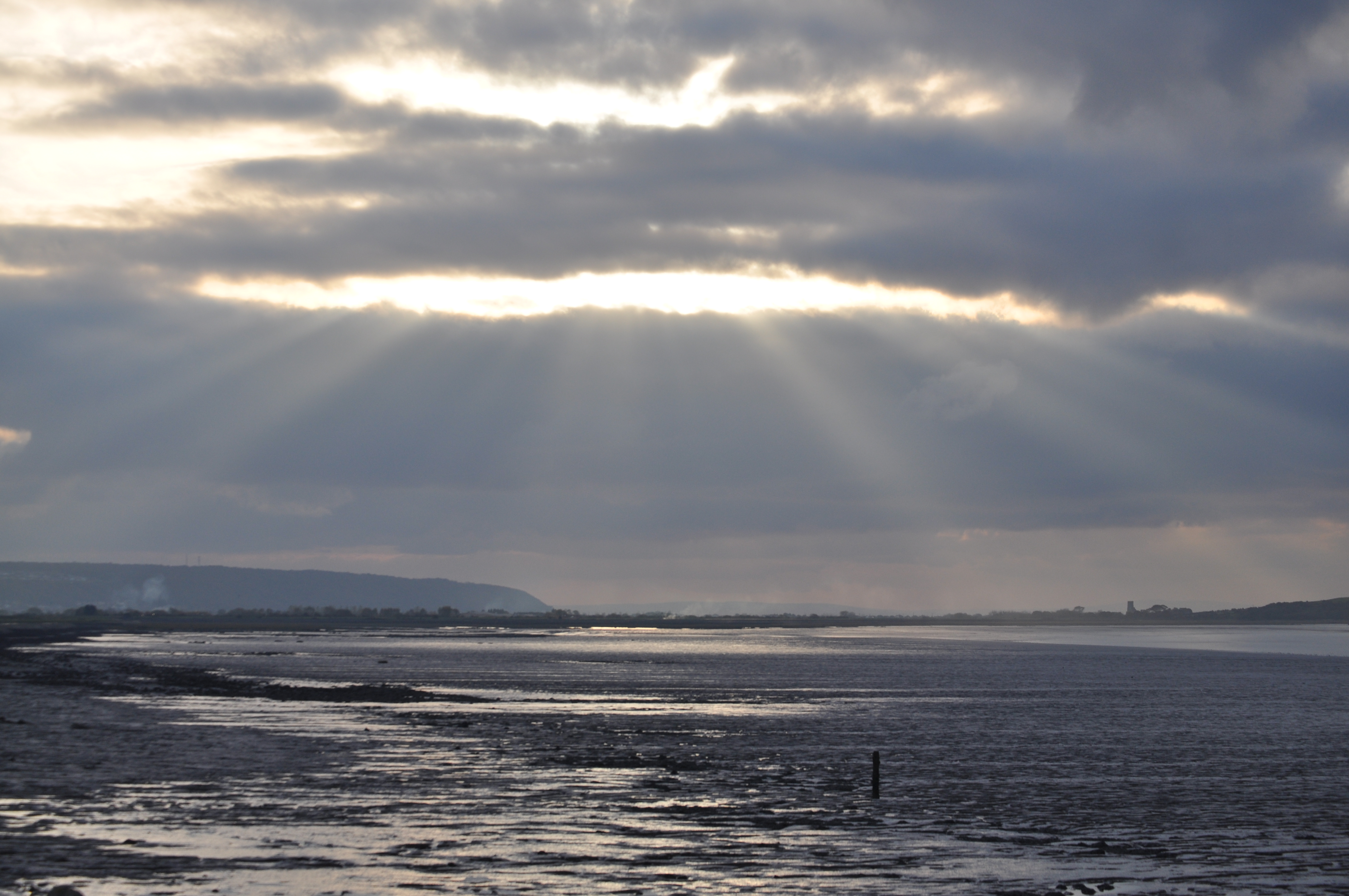
and continue 1300 metres to eventually end at the mouth of the river. In Woodspring Bay can be seen (when the tide is out)
THE WRECKS
of two
vessels.
If you turn left at the mouth of the river and
walk along the estuary for approx 200 metres you reach a wooden farm
gate which marks the entrance to Blake's Pools nature reserve. The
reserve is owned by the Environment Agency and leased by the Avon WildLife Trust. It forms part of the Severn Estuary Site of Special
Scientific Interest, Special Protection Area and RAMSAR site.
ACCESS
TO
BLAKES POOL'S
NATURE RESERVE IS BY PERMIT ONLY TO TRUST MEMBERS. PLEASE CONTACT
mail@avonwildlifetrust.org.uk OR TELEPHONE 0117 9177270.
Which ever route you choose retrace your steps to the start of the walk.
Warning:
I was aware that a permit is necessary for access to
Blakes Pools Nature Reserve Kingston Seymour
as I have walked and cycled this route (without incident
or a permit) several hundreds of times over a period of 6 decades
and seen signage to this effect at the entrance to Blakes Pools.
However, the Wharf Farm landowner prevented us from progressing
along the sea defences to the mouth of the Congresbury Yeo as to do
so would involve crossing his land.
He says the only way to walk the sea defences and cross his land is
by obtaining a permit for access to
Blakes Pools Nature Reserve Kingston Seymour
from
the Avon Wildlife
Trust
What has changed?
Completed the walk with my partner on November 7
2010.
weather bright,
temperature 6C, wind Was in the north east, tide was near low water.
here were our
sightings,
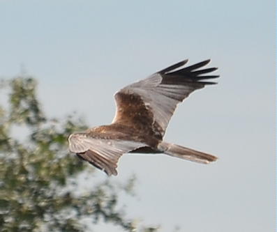
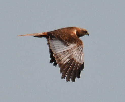
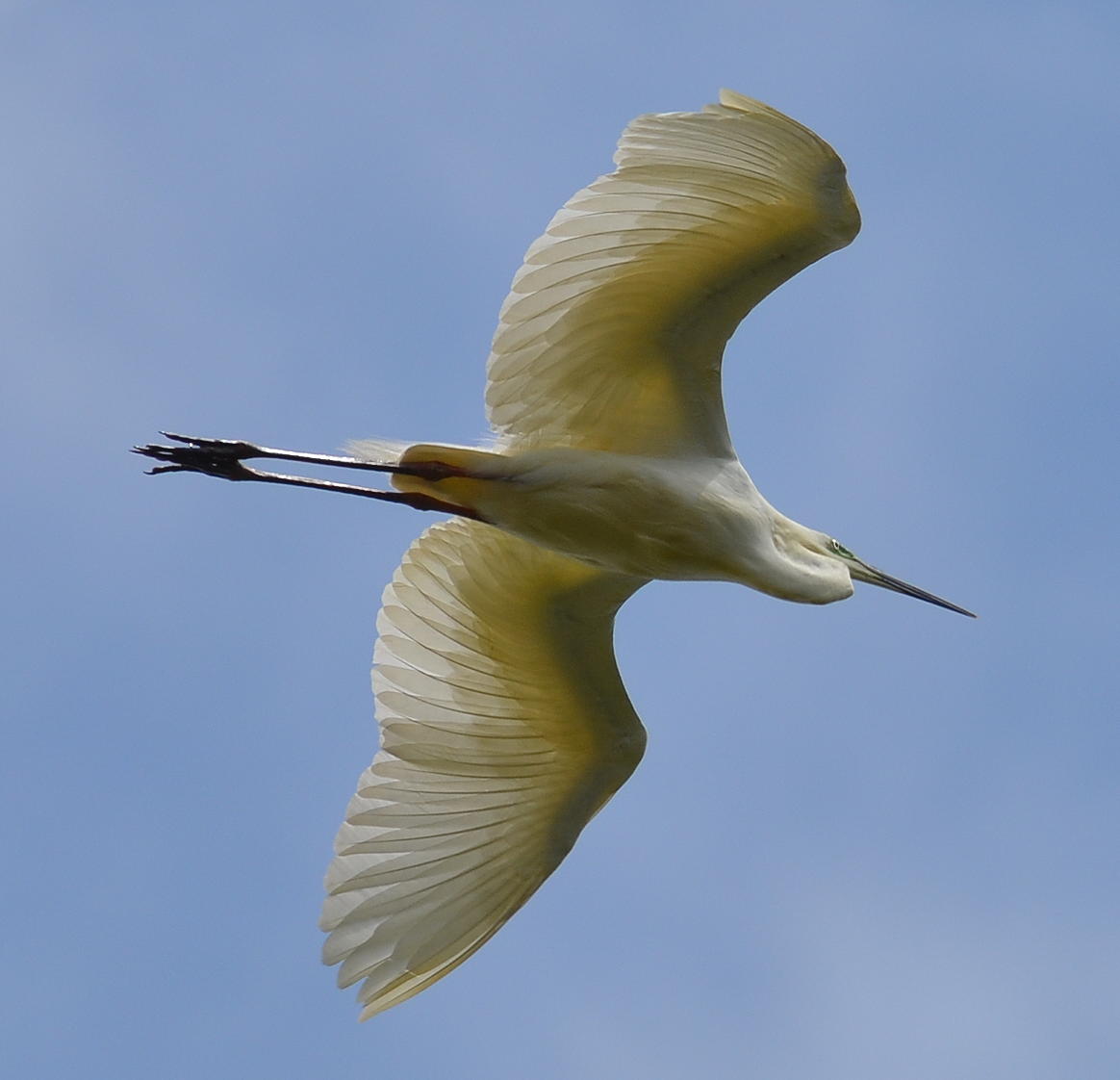
Marsh Harrier, Kestrel, Buzzard, Pheasant, Lesser Spotted Woodpeckers x
2, Greenfinches, Goldfinches, Chaffinches, meadow Pipits, RobinS, Starlings, Carrion Crows, Grey Heron, Long Tailed TitS, Blue TitS,
Linnets. Little Egrets x 4, BLACK HEADED GULLS, HERRING GULLS, redshanks, CURLEWS, LAPWINGS, SHELDUCKS AND OYSTERCATCHERS.
Back To Menu
A WALK ALONG THE CONGRESBURY YEO, NORTH SOMERSET.
START AT
THE END OF WEMBERHAM LANE, YATTON, NORTH SOMERSET. OS MAP 153
WESTON-SUPER-MARE AND BLEADON HILL. BURNHAM ON SEA AND CLEVEDON ST
408654.
A FLAT WALK OF 3.7km WHICH CAN BE WET IN WINTER.
PASS
THROUGH THE 2 GATES AT THE END OF THE STONY TRACK AT THE END OF
WEMBERHAM LANE.
ONCE INTO
THE FIELD (WHICH CONTAINS
THE SITE OF A ROMAN VILLA) LOOK FOR
A FOOTPATH MARKER IN A FENCE ON YOUR LEFT BEFORE TURNING RIGHT TO
FOLLOW THE ROUTE MARKED 'ROUND YATTON WALK'. FOLLOW THE RHYNE ON
YOUR RIGHT FOR 80 METRES TO ANOTHER GATE AND STYLE. PASS THROUGH
THIS GATE OR OVER THE STYLE AND CONTINUE KEEPING THE RHYNE ON YOUR
RIGHT FOR 500 METRES UNTIL YOU REACH SOME OLD STONE BUILT FARM
BUILDINGS.
GO THROUGH
THE GATE AND OVER THE STONE BRIDGE WHICH CROSSES THE LITTLE RIVER
INTO THE OLD CATTLE YARD. IMMEDIATELY TURN LEFT AND CROSS A STYLE
MARKED WITH A 'ROUND YATTON WALK' MARKER TO ENTER AN OLD CIDER
ORCHARD.
KEEPING
THE LITTLE RIVER ON YOUR LEFT AND AFTER 200 METRES LEAVE THE ORCHARD
BY THE GATEWAY OR STYLE.
CONTINUE IN THE SAME DIRECTION KEEPING THE LITTLE RIVER ON YOUR
LEFT FOR 800 METRES PASSING THROUGH OR OVER ANOTHER 2 GATES OR
STYLES BEFORE EVENTUALLY REACHING A WOODEN FOOTBRIDGE ON YOUR LEFT.
CROSS THE
FOOTBRIDGE AND CONTINUE FOR 20 METRES IN THE SAME DIRECTION TO REACH
THE CONGRESBURY YEO RIVER WITH THE PHIPP'S BRIDGE SLUICE ON YOUR
RIGHT.
TURN LEFT
( AWAY FROM THE SLUICE) AT THE CONGRESBURY YEO RIVER AND FOLLOW THE
RIVER WALKING ALONG THE RAISED BANK TO REACH A GATE AND STYLE AFTER
450 METRES.
PASS
THROUGH THIS GATE OR OVER THE STYLE AND CONTINUE FOLLOWING THE RIVER
FOR 750 METRES (400 METRES IF YOU CUT ACROSS THE RIVER BEND) TO
REACH ANOTHER GATE AND STYLE.
PASS
THROUGH THIS GATE OR OVER THE STYLE AND CONTINUE FOLLOWING THE RIVER
FOR 700 METRES TO REACH A RHYNE.
TURN LEFT
AND FOLLOW THE RHYNE FOR 200 METRES PASSING A SLUICE IN THE RHYNE TO
RETURN TO THE START OF THE WALK.
COMPLETED
THE WALK WITH MY PARTNER ON FEBRUARY 6 2011.
WEATHER
BRIGHT, TEMPERATURE 10C, WIND WAS IN THE SOUTH WEST, WATER LEVELS IN
RIVERS AND RHYNES VERY LOW.
HERE WERE
OUR SIGHTINGS, CARRION CROWS, GREEN SANDPIPER, GREY WAGTAIL,
HERRING GULLS, KESTREL, LITTLE EGRET, MUTE SWANS
AND STARLINGS.
Back To Menu
© Living On The Edge (North Somerset
Nature)